Not far from our trailer are the remains of an RV that burnt to the ground. Rumor is that it happened sometime last year.
Friday we hiked to Hess Mine on the edge of the hills to the west.
 |
| The Chocolate Mountains |
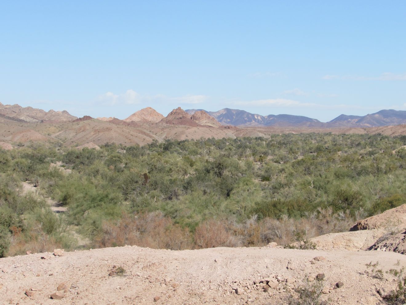
You can see the stripped sides of the hills the 2.3 miles from our trailer. Another blogger referred to it as 'marble cake'.
The first part of the trip was a short cut to a BLM road which goes to the mine. It goes by a mini airstrip which we deduced from the wind sock on it. The first 1.5 miles was fairly flat. We encountered two men walking back from that area. Then the road climbs a short distance before descending through a steep wash. From there, we could see a different route that looked less steep. We continued across an area with a bit of disturbed gravel. In another half mile we came to another crossing of the same wash up higher. In another .4 we got to the main mine area. The mine is a large area that looks primarily like surface mining.
 |
| Hess Mine |
There was some concrete, and a few rock foundations, but no significant structures. We decided we could do some more exploring across the width of the area, and perhaps climb up a road on the hill beyond where we stopped, but had gone far enough (about 3 miles at this point) for the day. On the way back, we decided to take the alternate route through the wash. Even though it looked lower, it was quite a bit rougher, so probably not a good way to go. However, there was a bonus for going that way. Just after crossing the wash on the way back, we came across a little area where someone had left several sticks with inscriptions on them, and a few 'headstones' that appeared to be for pets.
 |
|
 |
|
Additionally there was a cairn near here with something on it. A geocache? When we merged back with our route coming out, we figured it would be a good place to drive to so we would have more energy to explore the mine area another day. On the way back to the trailer, we followed a footpath along the edge of the wash that cut about 1/2 mile off our return trip. Our total trip was 5.5 miles.
Saturday it was time to do laundry. Not the best day to do that, but we needed fresh vegetables and fruit. We checked the internet for laundries in Yuma, since we have always used the RV Park one. Several had bad reviews. One of the better ones was in downtown Yuma. It was huge, and we thought there were enough washers open for us, but when we brought in the laundry, they were all filled, and hadn't been started yet. One woman was using at least 8 machines. So we drove out to the east end. The East Yuma Maytag Laundromat had enough machines for us. A smaller site, but still with quite a few machines. While we were waiting for our machines to finish, we wandered around the strip mall, and found the Bottoms Up Pub. Joan checked their menu, so after our laundry was finished, we had lunch there. Joan had a breakfast burrito without the 3 meats usually included. John had a prime rib dip sandwich. After stocking up on over $200 of groceries we headed back to the trailer. When we were unloading the truck, we found that one of our tops had soap soaked into a sleeve. John had put the soap bottle on top of a bin in the back seat of the truck, and it had tipped over. The cap on the vent end had come off, and most of the soap had drained out. Fortunately all of the soap wound up in the bin. There were a couple of big boxes of quaker oats in the bin. The cardboard was soaked, but the paper bags had kept the soap out of the oats.
Sunday morning we went to the garbage, threw out the two cardboard boxes and rinsed the soap out of the bin at the sewer dump. Then we drove toward Hess Mine. On the way out, we found what the airport is used for. There were 3 vehicles, with people 'playing' with remote airplanes. We parked about 1/3 mile short of where we planned to park, but figured that was okay. As we got to the mine, a group of 4 hikers caught up to us. One of them was curious about where we bought the 'heinie' pads, as she called them, which we carry on our fanny packs. We asked them about the best places to walk around the mine. One recommendation, for another day, was to take the side BLM road near where we parked to the south. In about a mile, take a trail to the west to find a turquoise mine. The suggestion we took for today was to head northwest along the wash toward a colorful dig in that direction. It was reasonable walking, about .7 mi to where we could see the width of the hill.
Along the way we saw one of the few geckos we have noticed this month.
We sat on some rocks for a snack and rest. John noticed a quartz chunk on the hill above us. There were 3 fairly deep holes there, so there must have been some gold here.
When we got back to the trailer, we were watching the replay, from the Raonic tennis match when it was interrupted by the news that Kobie Bryant had died in a helicopter crash. We were disappoint that they put an extensive special regarding Kobie, and showed the result of the Raonic match on the sports ticker at the bottom of the screen.
Monday we hung around the trailer doing some housework. In the afternoon we went for a little walk along the 3 roads with RVs in this area. We stopped to chat with a two couples from Logan Lake BC. The two fellows were in the group that caught up to us at Hess Mine yesterday. While we were chatting, the two other hikers in the group rode up on bicycles. Back near the trailer, we chatted with our next neighbours, a couple from Utah full-timing in a small trailer.
Tuesday, we dropped off garbage and picked up some drinking water at the facilities here. Then we drove back toward Hess Mine, stopping at a junction to a BLM road heading south along the foot of the hills. We followed this road south for .83 miles until we came to a road heading up into the hills. We followed it for another ?? miles. We found a large stone wall building, 12 yards wide by 18 yards long. It was near the top of a ridge going west.
 |
| Rock House |
We followed the trail along the ridge until we met a road coming along the ridge from the other direction. At the end of this ridge was surface area scraped with nothing significant. From here, at an elevation of 600 ft we could see three hikers on a saddle at 960 ft on the ridge to the west. We returned on the road, which switch-backed down the side of the ridge. Along this side there were many digs. We saw a few small bits of rock that look like turquoise. We assume this is the location of the turquoise mine.
From the here we could see the road going up the valley to Hess Mine, so we followed it until we got to a crossing of the wash below us just before the mine area. We followed this wash until we got to the road going back to the truck. There were a lot of burro tracks and human foot prints in this wash, so it is a popular short cut. This is one of the few places out here we have seen butterflies flitting around.
Wednesday morning we decided to head to Red Cloud Mine. To get to the mine, we go to highway 95 in Arizona, then back toward the river on Martinez Lake Road.
We came to the top of a steep hill 7.5 miles from the mine.
We weren't confident that the truck would make it back up the hill, and didn't want to take the chance of getting stuck out there. Fortunately there was a spot just wide enough to turn into to get the truck turned around. John walked down the hill with the GPS so we could see how steep it was when we got back. It turned out to be about 17% which in theory we should be able to do, especially with 4 wheel drive, but being stuck out in the hills could be an expensive proposition, if we could even get cell service to get help. We were in the Imperial National Wildlife Refuge, so decided to do a few things on the way back.
We parked at the entrance to Ironwood Point and walked in.
We had left some room for vehicles to get by, which turned out to be required as 4 atvs came along before we even got the 1/4 mile to the viewpoint. When we got back to the truck at least 6 jeeps went by but didn't go into the viewpoint.
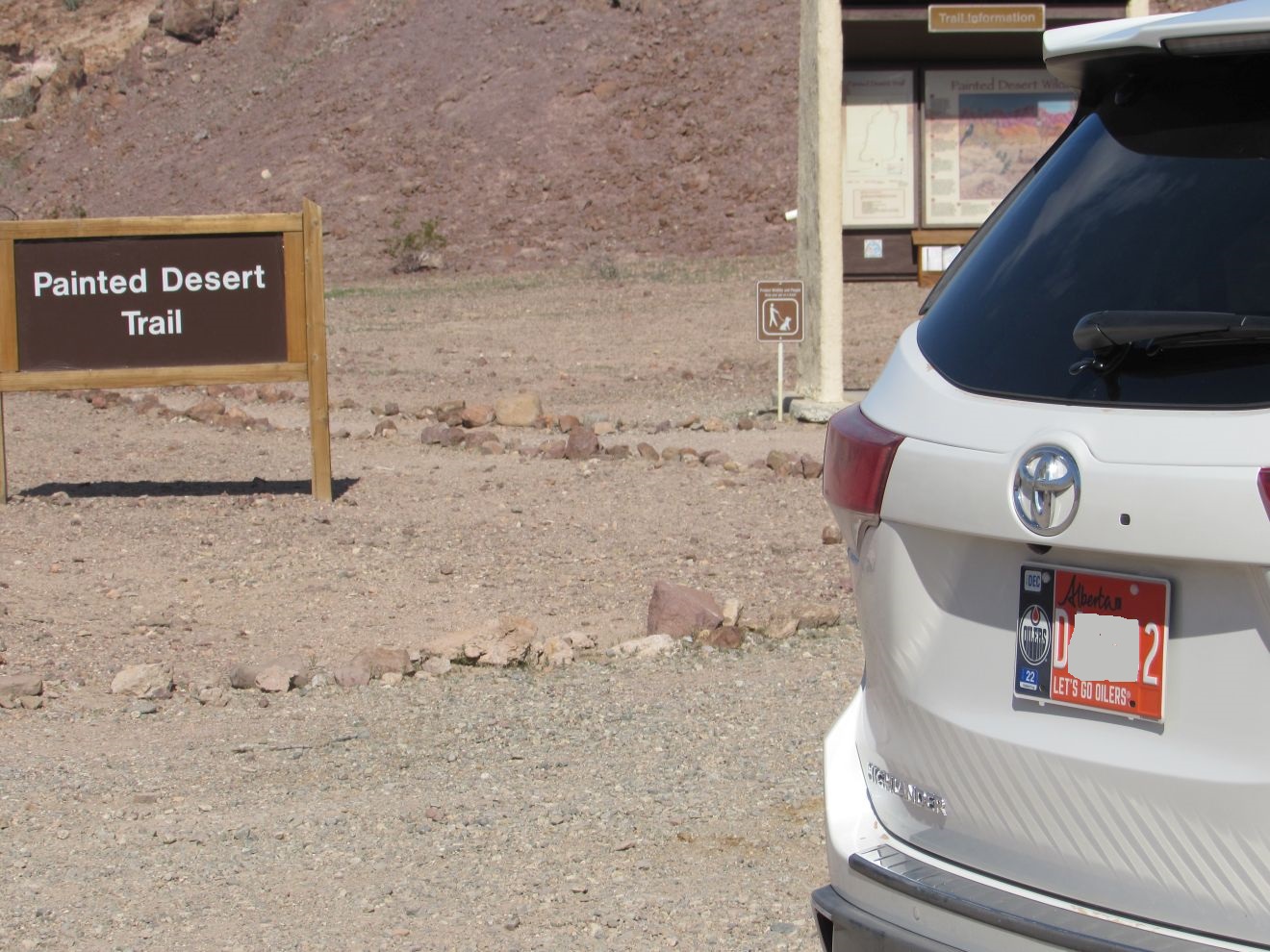
We then went to the Painted Desert Trail. It is 1.3 mile interpretive trail with 6 points of interest. There were about 6 vehicles in the parking area. Shortly into the hike we caught up with an older couple from New York. The trail has some moderately steep portions, and the woman was having some difficulty with footing, so we stayed with them and gave her a hand where she needed it. We took some pictures of them on their phone.
 |
| Hoodoo |
When we got back to the parking lot, there were cars from Manitoba, Saskatchewan and another Alberta. John was admiring the Oilers specialized license plate it when the owners got back from the hike, so we chatted with them for a while.
After having our lunch at the tables by the parking lot, we continued back to the Visitor Center for the wildliferefuge. There, a fellow from Quebec was looking through a scope, claiming to see a couple of black bears on the hill across the river. John did see what he was looking at, a couple of black dots, but there aren't any bears in this area.
It was very windy when we got back to the trailer, but the solar panels were still upright, being held by cinder blocks on each side and full 7 gallon water jugs on each side of the newer panel.


No comments:
Post a Comment