Thursday 30 January 2020

Week ending Jan 30, 2020 Imperial Dam LTVA - Painted Desert Trail


Not far from our trailer are the remains of an RV that burnt to the ground. Rumor is that it happened sometime last year.

Friday we hiked to Hess Mine on the edge of the hills to the west. 
The Chocolate Mountains
You can see the stripped sides of the hills the 2.3 miles from our trailer.  Another blogger referred to it as 'marble cake'.

The first part of the trip was a short cut to a BLM road which goes to the mine.  It goes by a mini airstrip which we deduced from the wind sock on it. The first 1.5 miles was fairly flat.  We encountered two men walking back from that area.  Then the road climbs a short distance before descending through a steep wash.  From there, we could see a different route that looked less steep.  We continued across an area with a bit of disturbed gravel. In another half mile we came to another crossing of the same wash up higher. In another .4 we got to the main mine area. The mine is a large area that looks primarily like surface mining.
Hess Mine
There was some concrete, and a few rock foundations, but no significant structures.  We decided we could do some more exploring across the width of the area, and perhaps climb up a road on the hill beyond where we stopped, but had gone far enough (about 3 miles at this point) for the day.   On the way back, we decided to take the alternate route through the wash.  Even though it looked lower, it was quite a bit rougher, so probably not a good way to go.  However, there was a bonus for going that way.  Just after crossing the wash on the way back, we came across a little area where someone had left several sticks with inscriptions on them, and a few 'headstones' that appeared to be for pets.

Additionally there was a cairn near here with something on it. A geocache?  When we merged back with our route coming out, we figured it would be a good place to drive to so we would have more energy to explore the mine area another day.  On the way back to the trailer, we followed a footpath along the edge of the wash that cut about 1/2 mile off our return trip.  Our total trip was 5.5 miles.

Saturday it was time to do laundry.  Not the best day to do that, but we needed fresh vegetables and fruit.  We checked the internet for laundries in Yuma, since we have always used the RV Park one.  Several had bad reviews.  One of the better ones was in downtown Yuma.  It was huge, and we thought there were enough washers open for us, but when we brought in the laundry, they were all filled, and hadn't been started yet.  One woman was using at least 8 machines.  So we drove out to the east end.  The East Yuma Maytag Laundromat had enough machines for us.  A smaller site, but still with quite a few machines.  While we were waiting for our machines to finish, we wandered around the strip mall, and found the Bottoms Up Pub.  Joan checked their menu, so after our laundry was finished, we had lunch there.  Joan had a breakfast burrito without the 3 meats usually included.  John had a prime rib dip sandwich.  After stocking up on over $200 of groceries we headed back to the trailer.  When we were unloading the truck, we found that one of our tops had soap soaked into a sleeve.  John had put the soap bottle on top of a bin in the back seat of the truck, and it had tipped over.  The cap on the vent end had come off, and most of the soap had drained out.  Fortunately all of the soap wound up in the bin.  There were a couple of big boxes of quaker oats in the bin.  The cardboard was soaked, but the paper bags had kept the soap out of the oats.

Sunday morning we went to the garbage, threw out the two cardboard boxes and rinsed the soap out of the bin at the sewer dump.   Then we drove toward Hess Mine.  On the way out, we found what the airport is used for.  There were 3 vehicles, with people 'playing' with remote airplanes.   We parked about 1/3 mile short of where we planned to park, but figured that was okay.  As we got to the mine, a group of 4 hikers caught up to us.  One of them was curious about where we bought the 'heinie' pads, as she called them, which we carry on our fanny packs. We asked them about the best places to walk around the mine.  One recommendation, for another day, was to take the side BLM road near where we parked to the south. In about a mile, take a trail to the west to find a turquoise mine.  The suggestion we took for today was to head northwest along the wash toward a colorful dig in that direction.  It was reasonable walking, about .7 mi to where we could see the width of the hill.
Along the way we saw one of the few geckos we have noticed this month.  


We sat on some rocks for a snack and rest.  John noticed a quartz chunk on the hill above us.  There were 3 fairly deep holes there, so there must have been some gold here. 


When we got back to the trailer, we were watching the replay, from the Raonic tennis match when it was interrupted by the news that Kobie Bryant had died in a helicopter crash.  We were disappoint that they put an extensive special regarding Kobie, and showed the result of the Raonic match on the sports ticker at the bottom of the screen.
    
Monday we hung around the trailer doing some housework.  In the afternoon we went for a little walk along the 3 roads with RVs in this area.   We stopped to chat with a two couples from Logan Lake BC. The two fellows were in the group that caught up to us at Hess Mine yesterday.  While we were chatting, the two other hikers in the group rode up on bicycles.  Back near the trailer, we chatted with our next neighbours, a couple from Utah full-timing in a small trailer. 

Tuesday, we dropped off garbage and picked up some drinking water at the facilities here.  Then we drove back toward Hess Mine, stopping at a junction to a BLM road heading south along the foot of the hills.  We followed this road south for .83 miles until we came to a road heading up into the hills.  We followed it for another ?? miles.  We found a large stone wall building, 12 yards wide by 18 yards long.  It was near the top of a ridge going west. 
Rock House
We followed the trail along the ridge until we met a road coming along the ridge from the other direction.  At the end of this ridge was surface area scraped with nothing significant.  From here, at an elevation of 600 ft we could see three hikers on a saddle at 960 ft on the ridge to the west.  We returned on the road, which switch-backed down the side of the ridge.  Along this side there were many digs.  We saw a few small bits of rock that look like turquoise.  We assume this is the location of the turquoise mine.

From the here we could see the road going up the valley to Hess Mine, so we followed it until we got to a crossing of the wash below us just before the mine area.  We followed this wash until we got to the road going back to the truck.  There were a lot of burro tracks and human foot prints in this wash, so it is a popular short cut.  This is one of the few places out here we have seen butterflies flitting around.

Wednesday morning we decided to head to Red Cloud Mine. To get to the mine, we go to highway 95 in Arizona, then back toward the river on Martinez Lake Road.

We came to the top of a steep hill 7.5 miles from the mine. 
We weren't confident that the truck would make it back up the hill, and didn't want to take the chance of getting stuck out there.  Fortunately there was a spot just wide enough to turn into to get the truck turned around.  John walked down the hill with the GPS so we could see how steep it was when we got back.  It turned out to be about 17% which in theory we should be able to do, especially with 4 wheel drive, but being stuck out in the hills could be an expensive proposition, if we could even get cell service to get help.  We were in the Imperial National Wildlife Refuge, so decided to do a few things on the way back.

We parked at the entrance to Ironwood Point and walked in. 
We had left some room for vehicles to get by, which turned out to be required as 4 atvs came along before we even got the 1/4 mile to the viewpoint.  When we got back to the truck at least 6 jeeps went by but didn't go into the viewpoint.

We then went to the Painted Desert Trail.  It is 1.3 mile interpretive trail with 6 points of interest. There were about 6 vehicles in the parking area.   Shortly into the hike we caught up with an older couple from New York.  The trail has some moderately steep portions, and the woman was having some difficulty with footing, so we stayed with them and gave her a hand where she needed it.  We took some pictures of them on their phone. 
Hoodoo
When we got back to the parking lot, there were cars from Manitoba, Saskatchewan and another Alberta.  John was admiring the Oilers specialized license plate it when the owners got back from the hike, so we chatted with them for a while.

After having our lunch at the tables by the parking lot, we continued back to the Visitor Center for the wildliferefuge.  There, a fellow from Quebec was looking through a scope, claiming to see a couple of black bears on the hill across the river.  John did see what he was looking at, a couple of black dots, but there aren't any bears in this area. 

It was very windy when we got back to the trailer, but the solar panels were still upright, being held by cinder blocks on each side and full 7 gallon water jugs on each side of the newer panel.

Thursday 23 January 2020

Week ending Jan 23, 2020 Imperial Dam LTVA


Friday, we used our sewer tote for the first time.  There is a clear elbow fitting on the top but you can't tell how much water is in the tote through it.  We ran about 20 second batches, starting with the gray water in case there was a problem.  Once we got it up to an acceptable level, where we were able to lift one end to get it onto the truck hitch.  We got about half a mile toward the sewer dump when we heard a different noise behind us.  It turned out that the cap had come off one wheel.  Fortunately there was a nice fellow nearby who helped us lift the tote into the back of the truck.  We took 3 loads to the sewer dump this way, and still weren't finished, although fairly close.  While we were doing this, our neighbour got his trailer slides in, hooked up and went to the dump, and returned.  We still think it will be easier to use the tote in the long run as we have to do a lot of reorganizing to run trailer slides in, but will definitely do a run more often.  Now we have an idea of how often we will need to use the tote.
In the evening, we had a bit of panic when we heard on CTV Calgary News that Primecare Health Services hadn't paid their employees and was being sued by ATP for repayment of loans.  Our doctors are with Primecare Medical Clinics, which we were pleased to find out aren't associated with Primecare Health.  There is even a website clarifying they are not the same.

Saturday morning was warmer than it has been, but the north windchill more than made up for it.  We ran the generator for more than 4 hours to see if we can get the batteries fully charged.  Took advantage of the extra power to make soup.  In the afternoon, we went for a walk back to where we had lost the wheel on our tote, about 1/2 mile.  We didn't find the cap for it, but we did find the inside bushing.  It looked like someone had set it on the berm next to the road very close to where we stopped.  When John put the bushings on the wheel, he noticed a bit of moisture on the bottom of the tote.  A small hole had been scraped through the fibreglass body.  Time for our go-to leak sealant, eternabond tape patch over the hole.  We'll see how that works. 

Sunday morning, we went into Yuma for breakfast at Black Bear Diner.  Joan had checked their menu a while ago, and wasn't optimistic about vegetarian options.  However, she did find some options this time.  After breakfast, we picked up propane.  We have used about 2/3 tank this month for the heater and a bit more for the fridge and stove, and well under 1/2 a tank for the bbq.  We also picked up an assortment of cotter pins to see if one of them would work to replace the axle cap on the sewer tote.  We were able to get one of the pins around the axle.  We'll see how it works.

By Monday Joan's knee was feeling pretty good, so we did a walk around Senator Wash Reservoir to the North Shore.  We based our route on google maps satellite view, which shows the unmarked roads around the area.  We followed Lopez Parkway which goes down into the wash from the LTVA office. On the north shore, on a rise above the reservoir, we came across a trailer with a great view reservoir.

Some trailers park next to the reservoir, despite signs which warn people to move to higher ground if they hear warning sirens.  This indicates water may be released due to high water flow requiring water to be release from behind the dam. 

We saw a hummingbird,
?
and what we think was an eagle, but our picture was only from the back.

Senator Wash Reservoir
The Senator Wash Rec Area on the north shore has a $10 daily permit or $75 annual permit.  Camping is allowed for a 14 day period, the standard non-long-term BLM term.  There are pit toilets in several locations.   We chatted with a couple who camp here, then move to Oxbow Rec Area, which has the same rules.  It is located near Cibola Wildlife Refuge south of Blyth.  The drawback is that there are no garbage, sewer or water facilities.   You lose a lot of benefits for almost half the price of the LTVA permit.  Back at the LTVA, we headed for the showers, which felt really great after the walk of 4 miles. Joan's knee held out well for this hike.     On our way back to the trailer we saw a man and 2 youngsters on the slope below the causeway,
grandad and kids working their way down steep slope
an elephant statue in the Hurricane Ridge area, 

and Joan was lucky to spot 2 burros.   We had do some maneuvering to get back to a spot where we could see them. 
Checking the view between its legs


On Tuesday, we decided to go looking for the rock dam mentioned by some miners we talked to last week on the hike when Joan aggravated her knee.  We drove west toward the hills, parking at the rock garden.  A road goes south along the power lines from there.    When we got to where the two power lines split, we chose the right hand side, which was the steeper of the two choices.  We could see the tower we were heading for last week. 

Once we got up to the highest point on the power line, the BLM road headed west toward the tower.  
Hopefully we could get to it from here.  We could see what looked like it might be the rock dam we were searching for, but it turned out to just be a little build-up of the BLM road.  At the 1.5 mile point, Joan decided she had gone far enough for the day, given the steepness of some of the road. From here we got good views of the LTVA to the north,
and south over the reservation toward Yuma.
Vegetable fields on reservation
and back over the LTVA.
John opted to continue about .5 miles further along the BLM road.  Shortly he heard a burro snort on a little ridge to the north.  There were 5 burros there, carefully watching.  You can just pick them out of the background by their white noses, but John was able to get to point where they had the sky behind them. 
5 burros
When John got to the high point on the road, he could see down the valley to the south, and the tower about 1/4 mile to the left along the ridge, but the only reasonable way to get to it, would be to carry on down into the valley, and then go up a road to the tower.  We have seen the roads these roads when we drive back from Yuma on the California side of the river.   Back near the truck we noticed a large quartz boulder in a wash.
Large quartz boulder

On Wednesday, we went back to the same route as yesterday, parking a little further out, as the road to there was less steep through the wash.  On the way out, we saw an egret on a rise above the gravel pit.  Because we were in the truck, perhaps, we were able to get quite close to it.

When we got to our start point, a bit past the powerline, we walked south along the powerline again, then where the powerlines split, we went on the shallower route, south toward the Quechan Reserve.  Eventually, we got to the canal that curves around past this point.  Joan sat for a bit, while John walked east along the canal.  He got to the "catfish" power pole we had been told about. 
Power pole with catfish skulls
From there, he could see a fireplace structure along a wash just east of the wash we had come down.  When he headed back to Joan, she had started down into the wash to head back to the truck.  We were able to loop back to the fireplace. 
There were a couple of mine holes into the walls on each side of the wash. 
 One of several digs into the rock
We returned to the truck.  On the way back to the trailer, we saw the egret in the gravel pit again.  It's not far from water, but still a pretty dry spot for an egret.  Perhaps looking for a place to nest?   
Egret in Gravel Pit
Thursday morning after a quick breakfast, we put our propane tanks, bbq, sewer tote and steps in the back of the truck and went looking for a new campsite in the northwest corner of the LTVA.   We have done all the routes close to the south west end.

We found a spot looking east to Senator Wash Reservoir. 

When we started looking around, a lady came out of her unit.  She told us she had put rocks in the area next to her, because someone had parked too close to her.  They added injury to insult by pointing their generator toward her window.  Fortunately they didn't stay long.  We found a spot not too near her, and left our stuff while we went back to pick up the trailer, fill up the fresh water tank and dump the sewers.  

Thursday 16 January 2020

Week ending Jan 16, 2020 Imperial Dam

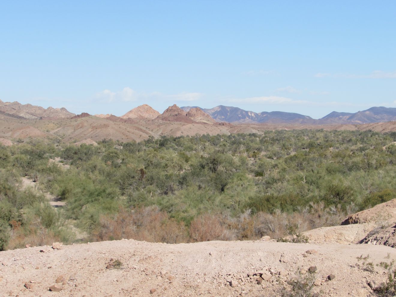
Friday was cool and windy.  We ran the generator for a while, since we didn't get a full dose of sun on Thursday.  Then we waited until after lunch to walk to Old Senator Mine, which is one of 3 mines near the LTVA.  In fact it is only about half a mile from the main road into the LTVA.  After walking 3 miles, we were within 1/4 mile from the mine, but our GPS showed it was up a little gap in the hills on the east edge of the Kripple Kreek area of the LTVA, a little alcove with only about 6 units in it.   John did some scouting up the gap, to see if it was worth Joan climbing up.  It wasn't as still about an 1/8 of a mile from the mine, there was a little cirque of hills, and a pretty good clamber to get over the rim to the other side.  On returning to the trailer, and checking the satellite view of the area, we found that the mine was on the far side of the hill, and that there were trails around the east side to get to it.  Another day. 

Saturday morning was colder, 39F, so we headed to the campground area at Squaw Lake, still in the LTVA.  There are several shower building there that operate on $1 tokens.  Then we went into Yuma for breakfast and groceries.

We stopped at DD's Discount, where Joan found some pants and tops.  John picked up a new cap.   When we got down here, we realized John had left his hat in his golf bag at Trev's.  He bought a cap for $3 at Walmart in Laughlin after a few long hiking days.  Earlier this week, we couldn't find the cap anywhere in the trailer or truck.  Joan said if we bought a new one, we would find it.  True enough.  Later when she was going out of the trailer, paying attention to get on the stairs, she saw the cap caught on the cross bar of the steps.

When we stopped for diesel at Fry's, although there are a lot of diesel nossels, they were all being used by people using the gas nozzle on the same pump, leaving most of the gas-only pumps empty.  We got in line behind one lady, and when she was done, we pulled up, only to find that her husband, in another vehicle, had started pumping gas into his car on the other side.  That way they only had to enter their credit card once?  To make matters worse, he then proceeded to fill 3 10 gallon gas containers.  Every time we saw another pump come open, someone pulled into before we could get around.  If Trev had seen this, he would have given them a lecture on being considerate by using the gas only pumps unless they were all in use.  On the way back to the trailer, we stopped at a historic sign at the site of the Mission San Pedro y San Pablo de Bicuner.  It was built near here to protect the Spanish Anza trail from Tucson to California.  The Quechans (Yuma Indians) attacked the settlement in 1781, which closed this crossing of the Colorado River.

Sunday morning we walked east along the canal.  We immediately heard shotgun blasts, and saw flocks of ducks fleeing.  It looked like 3 hunters west along the other side of the canal.  Duck hunting along the Colorado in California is from Oct 18 until Jan 26.  We came across one of the few phainopeplas we have seen this year.
Phainopepla
We continued along the canal past the road coming into the LTVA, continuing toward the dam area. Across the pond, we could see the road up to Old Senator Mine.
Then we came to the desilting ponds in front of the dam with scrapers. 
desilting scrapers
When we got near McKinley Road, which goes to the dam, we encountered a group taking pictures of birds.  They said they were travel journalists at the Yuma Bird, Nature and History Festival. From there we walked 1/4 mile up Mckinley Road to an old mining road up into the hills. 
 Approaching the mine
When we got to the Old Senator Mine Area, we were confronted with a 3 line barbed-wire fence, with No Trespassing signs.  The fence completely circled the mine area, going down through the wash, and up the side of hills.
We choose to obey no trespassing notices, but got some pictures of the mine, from a bit of distance. 

While we were sitting down for a drink and a snack of trail mix, we heard voices above us, two people going along the crest of the hill.   We don't know if they noticed us or not.  When we got back down to McKinley Road, we saw them just starting on the canal route, and we followed about 1/4 mile behind them all they way back to where we leave the canal near the trailer.   Along the canal, we saw a heron sitting on one of the structures in the ponds around the dam, with a nice palm tree behind it.
  Further along we saw a kingfisher.  At first it was sitting on the powerline.  Then it flew over to a power pole, where it posed for a while. 
Further down the canal was a cormorant on a wire across the canal.

Cormorant drying its wings

Monday, we drove the road west towards the hill, and parked at the junction where we went to the pickup trailer last Tuesday.   We walked toward a tower we have seen to the west.  We went the end of the road in that direction, which was only about 3/4 mile.  We figured we could make it up a burro trail to the ridge above the end of the road.  However, Joan slipped trying to get up a larger than normal step out of a wash and strained the muscle in her knee, so John, after making sure she was okay, headed up to the ridge.  The tower was still a couple of ridges away, so no reasonable access.
tower three ridges over, at least
We returned toward the truck, and Joan's knee was feeling okay, so we followed a side road up which we had seen a miner coming out a few days ago.  When we got back into that area, we encountered a couple from Prince George, and their friendly rotweiller named "Miner".  They were doing some dry wash mining here under the SPMA membership.  Back in BC, they spend most of their summers doing the same kind of mining there.   They mentioned a couple of things to check out in the area, the "rock dam" and the "catfish pole".  We'll have to see if we can find some info, or maybe just hike out in the direction they described and hope for the best. 

Joan put a heating pad on her knee for the afternoon and took Tylenol to get a decent night's sleep. 

On Tuesday, she was limping pretty badly so she stayed in the trailer and washed the dishes while John did the 2 1/2 mile walk to the garbage at Quail Hill in the morning.   Joan did a bit of walking in the trailer to keep the knee mobile.  In the afternoon, John walked back to the pond we had seen last Thursday to take pictures from the hill to the north of the pond, following burro trails, since they know the easiest routes. 
Ducks on canal
He was lucky enough to see an egret fly onto a tree on the edge of the pond, and a heron fly across the pond to a tree on the south edge.  
 Egret
Heron in flight, Egret on left

Heron
On the opposite side of the canal, there were a couple of duck hunters who had a kayak, instead of a retriever, to get their ducks.  They had already beached the kayak and then put it back on their truck.    On the canal, there were racoon tracks.


Wednesday, we had to run the generator again, as we had a bit of cloud.  This gave Joan a chance to use the induction cooktop to make potato salad.  In the afternoon, we went into Yuma to pick up more gas for the generator, as we hadn't expected to run it as much.  Joan's knee was feeling a bit better so she could do this, make it to the truck, and into the grocery store with the aid of a grocery cart.  She is still getting twinges when she turns at all.  We also found a business that takes recycling, so were able to drop our plastics, cardboard, etc. 

Thursday, we drove into Quartzite to pick up a sewer tote, a few led lights to reduce battery use when the solar panels aren't generating.  Then we went to Solar Bill's to see if they have a battery monitor.  The only model they have is $359, and we figure we might get more out of another battery or solar panel, so passed on that.  On the way back to the trailer, we stopped at a historic marker for an elaborate concrete-lined stone-faced paint shed

built by Italians prisoners-of war at the Yuma Test Branch toward the end of World War II.  The Test Branch was testing methods to build floating bridges on the Colorado River in this area.   
When we got back to the trailer we figured out how to use all of the bits that attach to the sewer tote.  Soon time for a run to dump our sewers, so we'll see how that goes.   As the instructions say, without saying how, don't overfill the tank.  Hopefully the clear elbow connections will let help tell when it is time to close the valve.  The neighbours seem to deal with this problem by dumping their sewers every few days.  We have been over two weeks, so will have to be careful.