On Friday we did a walk around the park since Vic had said he might be able to come out Friday afternoon to install our fridge.
Vic arrived about 8:30 AM on Saturday to install our new fridge. It took him a bit over half an hour to get it all done. Then we had to let it cool off before we could put our food in it.
Sunday was spent watching curling and the Daytona 500. We also talked to folks from Nanaimo who we met on a walk around the park.
On Monday, we returned to the American Girl Mine area. In the meantime, we had downloaded a California topo map which marked the roads in the area, and points of interest, which included the location of the American Girl Mine. We followed the route out to the mine. Along the way, we investigated a little tunnel into the side of a hill.
 |
| small tunnel dig on way to American Girl Mine |
Then we came to the east end of a huge .4 mile long tailings pile.
Soon after we passed the west end, we were able to get to the rim of the large mine pit. We could see that there were ATV tracks from the far end toward the pool of water at the east end of the pit.
 |
| American Girl Mine pond from north |
 |
| American Girl Mine pond from east |
We walked down about 150 feet from the top of the mine down to the pool, where we had lunch. While we were there, we waved to a couple looking down from the top of the mine.
 |
| cattail on edge of pond |
On the way back we got good views of the Imperial Dunes to the west.
 |
| view of dunes from American Girl Mine |
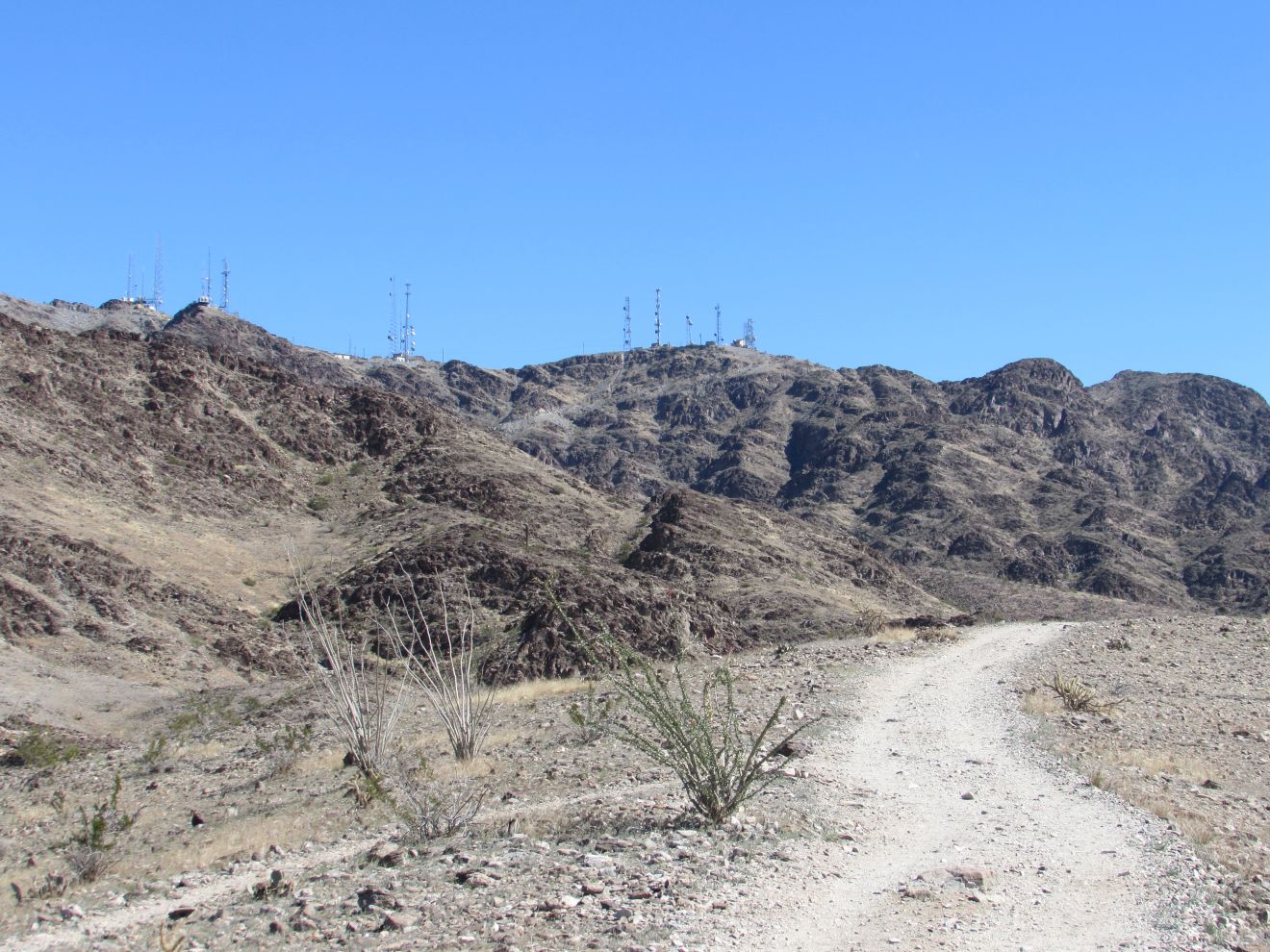
Tuesday we drove to Telegraph Pass to do the hike there. We had picked up a sheet describing it at the visitor center with instructions on how to get to the trailhead off I-8 at Foothills Blvd to the north frontage road along the interstate. There are several different paths that lead about a mile to the entrance gate that the road that climbs up to the communications towers at the top of the hill. We, of course, started out on a road with lots of footprints which led up to a power pole. While not quite a dead end, the trails from there looked a bit challenging, so we returned to the parking, and chose the power line access road around the south side of the hill, beside the freeway.
 |
| heading to Telegraph Pass |
This worked out much better. About half a mile out, we had a choice between continuing on the powerline road, or taking a more direct trail across to the entrance gate. We reached the entrance gate in another mile. At that point, we started climbing up the concrete access roads towards the towers at the top, at 700 foot elevation, only about 900 feet more to the top of the hill. This was a busy hike, with a few people heading up, and more on their way down. We continued almost 300 more feet of elevation up the hill before we stopped to eat our lunch. Then we decided it was going to be too difficult to make it to the top. On the return trip, we followed the access road back toward the interstate, then the powerline road back to the trailhead. We noticed another couple choose the wrong route on this section, and have to return from a deadend at a power pole site. When we got back to the point where we had headed off the powerline on the way out, we took the path around the north side of the first hill. We had asked a couple of girls why they hadn't gone back that way. They said it was 'creepy'. We took that route, and didn't see anything that justified the 'creepy' description.
On Wednesday morning we finally remembered to phone Dometic Customer service because the on-line registration form did not recognize the model number / serial number combo. They acknowledged that there was a problem with serial numbers starting with letters, so they did the registration. After stopping for a slow breakfast at IHOP, we headed to Picacho California State Recreation Area 24 miles north of Yuma on the west side of the Colorado River. The first 6 miles of the road are paved, and the last 18 mile are rough washboard gravel, with a few smooth breaks.
It took us about an hour to do that 18 miles.
 |
| views along Picacho Road |
Along the way we came to a work site. We didn't see any signage indicating what it was for, but they sure didn't want anyone going in.
 |
| secured work site |
|
A couple who had driven their small RV in said it took them 2 hours, so they decided to stay in the campground for the night. The scenery on the drive is quite good once you get into the hills. There are lots of different colors in the hills. There is a self-pay kiosk at the entrance to the SRA which is $10/veh but $9 seniors, if you can find the exact cash. They had a few brochures, including a hiking map and the interpretive guide for the 2 mile Stamp Mill Trail. It goes up and down along the edge of Rojo Grande (Big Red), where there was a mine in the late 1800's that had up to 700 workers with a townsite of 2500 people. The town was supplied by steamboats, and was swamped later when the Imperial Dam was built downstream.
 |
| Colorado River |
 |
| across the foot of Rojo Grande |
Close to the stamp trails, we crossed a wash.
There are remains of 2 stamp mills at the end of the trail, one on the side of the hill and the other near the river.
 |
| upper stamp mill |
 |
| lower stamp mill |
On the way back, we checked out the jail with bars across some of the opening.
 |
| Jail | |
We saw a heron fly into one of the pools below us, and noticed an egret there as well.
 |
| Egret |
 |
| Heron |
On Thursday, we went to the Heritage Library in Yuma to download some windows 10 updates, since neither our Verizon wifi or the campground wifi is fast enough to do a significant update. However, Joan's computer still gets an error message trying to apply an update, and the update for John's computer got into a loop. After downloading the latest update, then starting to install it, it would start downloading it again. Over 7GB later, he gave up.
We then drove south about 22 miles from Yuma to the border town of San Luis. We were surprised to find a Wal-Mart at the edge of town, so we stopped in to stock up on some boxes of wine and pick up a couple of small thermoses that we can put a cold drink in to enjoy when we get back to the truck from a hike. We took a picture of the Catholic church.
 |
| St. Jude Thaddeus RC Church / Mission |
One more week left in our month in Yuma.


No comments:
Post a Comment