Thursday 28 June 2012

Week ending June 28, 2012


We headed 
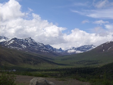
north-west from Haines Junction on Friday mid-morning, along the edge of Kluane Park. We stopped close to the south end of Kluane Lake, the Yukon's largest lake, for a short hike along the old Alaska Highway, which went over a shoulder of the hill, to Soldier's Summit. This was the location where the official ceremony was held to open the Alaska Highway. We chatted with a couple from Seattle, who had come up the Inside Passage on the ferry from Prince Rupert. We drove the rest of the way along the lake to Burwash Landing, one of the oldest settlements in the Yukon. We toured the very nice Kluane Museum of Natural History. They have excellent displays of the native animals and birds, and of the clothing and tools used by the native people. On the way back, near Congdon Creek campground, a grizzly was coming along the highway toward us. Before we got near it, it went off the edge of the road down toward the creek. We were able to turn around at the campground and come back to get some pictures of the bear as it went down along the creek. 

Carrying on, at the south end of Kluane Lake, we noticed a vehicle down by the shore with a woman waving frantically at us. We pulled onto the turn-off by the lake and saw that they had gone down into the sandy area by the shore in their SUV and had their rear tires deep in the sand. They had a tow rope, but it only reached about halfway to an area of solid gravel. Shortly after, a Yukon government employee stopped to help. He had another tow rope, so we were able to back close enough to the suv to attach, and have the front tires on the solid gravel slope. After digging out the back tires of the suv, and some pushing, we were able to use the 4-wheel drive (for the first time) to pull them up to solid ground. When we got back to Haines Junction, we stopped at the bakery where we had a nice bison cheese dog and bumbleberry scone, and picked up a loaf of bread.

We had been watching the weather forecast for a good day to do an airplane flight over Kluane, and Saturday was predicted to be clear. We took the Grand Mountain Tour, a 75 minute flight in a Sifton Air 5 passenger Cessna 206. This tour flies up the Kaskawulsh Glacier which flows off the Hubbard Glacier, one of 4 main glaciers starting from the icefields around Mount Logan, Canada's tallest mountain. 

The Hubbard Glacier goes 76 km down to the coast in Alaska. Since it such a clear day, we got beautiful views of Mount Logan. 

We got some pictures of the beautiful sapphire (?) colored glacial pools. 

On the loop back towards the airport, we came down to Lowell Lake, filled with little icebergs that calve off the Lowell Glacier. These icebergs float around in the lake all summer, as the drainage is too shallow for them to move into the Alsek River. 


Sunday was a very quiet day. We drained the trailer and refilled the water tank. Then we watched the NASCAR race.

We moved to Whitehorse on Monday, back to Pioneer RV Park where we stayed before.

We went to visit a friend here on Tuesday. Jackie is visiting her daughter and family on their acreage at the edge of Whitehorse. We spent a very nice afternoon with them. On our way back to the RV Park, we checked a few places looking for a spring to replace one that broke in the recliner chair. We found one at Home Hardware that was an exact match. Now we just need to figure out where to install it in the recliner.

Wednesday morning was laundry time. After laundry, we installed the spring in the recliner. We had looked at it before to see if we could figure out where to install it, without any luck. Today, we were able to find a picture of a similar recliner mechanism that showed roughly where the springs needed to be connected.

After lunch, we went to the Berengia Interpretive Center on the highway beside Whitehorse. This was well worth the $10 (for two seniors). Berengia was a dry area with extensive grasslands that covered both sides of the Bering Strait, from Siberia across Alaska and the Yukon. It was created during the ice ages, because the seas dropped about 100 meters due to the amount of water that was trapped in the glaciers. The center has some excellent skeletal reconstructions of mammoths, short-faced bears, sloths, scimitar cats, giant beavers (the size of a black bear) and other large animals that lived in this area during the ice age. There were also displays of human habitation from this era. They had several short films that provided explanations of the phenomenon. 

After we were done there, we went to the local Honda dealer to buy an inverter/generator for the trailer. This will give us more flexibility in campgrounds, as we won't be as dependent on having a powered site.


We packed up again on Thursday morning, and headed down the road to Atlin, BC. Although not a long drive, it was a little more challenging than most. About 60 km of this road is gravel, including a rough section of about 10 km that was under construction. By the time we got to Atlin the lower parts of the truck and trailer were covered in a slimy coating of mud. The campground here is a little more primitive than most, with only 6 water and power sites (no sewer). However, we were fortunate to get the 'Penthouse' spot, which is on a strip of gravel built between the marina and the houseboat moorings. The houseboats used to be short term rentals, but now appear to have full-time tenants. We also have wi-fi, and were able to get the satellite working.
The views are fantastic, with mountains rising along the west side of the lake. As we were relaxing in the trailer in late afternoon, a bald eagle landed on a platform behind the trailer, and proceeded to eat the animal or fish that it had caught.

Thursday 21 June 2012

Week ending June 21, 2012


On Saturday morning, we drove up to Midnight Dome, a hill behind Dawson City. From the top, there are extensive views in all directions.  Here is a view of the Yukon valley as it heads toward Alaska. 


On the way down, we got some pictures of a fox on the road. 

We checked out the farmers' market, but it is too early to have any produce.  As we were walking along the dike that protects Dawson from the Yukon flooding, we saw the SS Keno on the river practicing abandoning the boat if it lost power and was swept downstream, very quickly.  They would run the boat upriver for a while, then cut the engines, letting the boat drift, then restart the paddle-wheels and head upstream again.


We drove the 96 km Hunker Creek / Bonanza Creek mining loop. This is a mainly a gravel loop, mostly not too bad in the lower valleys, but the road climbs up on a ridge between the two creek beds, along King Solomon's Dome, which is believed to be the location of the mother lode that fed gold down the creeks in all directions. This part of the road is not so much gravel as packed sand, so has a lot more potholes and ruts. The views from the top of the ridge were fantastic, with a 360 degree view for huge distances.  These views never look as impressive in a picture as they do in person. We stopped at the two main National Park Historic sites on Bonanza Creek, the Discovery Claim, and Dredge #4 to learn more about the gold rush. 

When we got back to the RV park, we filled up the truck, getting the 4 cent/liter discount for campers, but weren't able to get the discount on the fill we did when we first arrived (before we knew they offered the discount). Then I took the truck over to the car wash, to remove the calcium chloride mud that comes of the gravel in this area (where they have treated the roads to keep down the dust). The wash wouldn't start after the money was put in. It turned out that the compressor had been unplugged. By the time that was sorted out, I only had a couple of minutes left on the timer (apparently it wasn't unplugged). It took a while for the clerk to find the manager to give me some more time.

We drove back from Dawson City on Tuesday. We saw a fox crossing the highway not too long after we started, but it was moving too quickly to get a picture. The trip back to Carmacks was fairly uneventful, as we are just retracing our path here.

Wednesday morning, we were off early as we didn't unhook the truck. We drove back to Whitehorse, mostly in rain, picked up some groceries and a cigarette lighter USB adapter for the phone. Since we had no cell service since we left Whitehorse for Dawson City, we hadn't recharged it. Even leaving it at customer service in Superstore while we shopped didn't get it charged enough to use. Shortly after leaving the coverage area in Whitehorse, on our way to Kluane Park, the phone was charged enough to find out that we were out of range. The 'Fas Gas' RV Park in Haines Junction has 30 amp power, but no water or sewer. We emptied our tanks, filled up our fresh water tank and paid for one night, to be sure we could get wi-fi and satellite before we committed to longer. As I was setting up the satellite, the next door neighbour (i.e. The only other trailer in the park at the time) came out, and I asked him if he had a satellite signal. We checked his settings, and I found my dish angle need to be raised, and we wound up with a better signal than the neighbour. We chatted for a while with him about our stay in Victoria, as he is thinking of heading there for the winter. Then we paid for 4 more nights, since everything was working fine.

When we went to the Parks info center on Thursday morning, we found out that there was a blessing ceremony to officially open the new DÄ KŲ Cultural Center of the Champagne and Aishihik First Nations . It also is the new home of the Kluane National Park visitor center and the Yukon Government visitor center. After enjoying the ceremony, we drove south down highway 3, and walked the Rock Glacier trail, a 1.6 km trail climbing out of the valley to the rock scree at the foot of an old glacier. There were great views of Dezadeash Lake in the valley. 

Then we stopped at Kathleen Lake on the way back. We learned that Kokanee salmon are Sockeye salmon that no longer go downstream to the ocean, but stop in a freshwater lake before going back upstream to spawn. We a short walk along the edge of the lake very quickly, because the mosquitos were quite bad, and the repellent we used on the previous walk had worn off. 

As we continued back to the campground, we encountered a mother moose with a calf on the edge of the highway. They stood on the edge of the road with the calf tucked under mother, looking out at us from the far side of her. By the time we got the camera ready, and tried to zoom in a bit, they had turned and headed down the highway. The walked along the edge a bit, but as we slowly moved toward them, the made a bee-line into the bush, and had disappeared by the time we got to the point where they headed off.

Saturday 16 June 2012

Week ending June 15, 2012


We took Friday morning to do catch up on laundry, and to wash the gravel off the back of the trailer from the several gravel stretches on the road from Watson Lake. After lunch we drove the few km into Whitehorse to get some groceries and do the tour of the SS Klondike, the paddle-wheeler that used to carry supplies down the Yukon River to Dawson City, and then bring the silver ore back up the river to Whitehorse from the Keno area east of Mayo.


We were going to go to Haines Junction, next to Kluane National Park on Saturday, but the weather forecast looked better on Sunday, so instead we decided to do some things around Whitehorse. In mid-morning, once it had warmed up a bit, we went over to Miles Canyon, which is on the Yukon River close to the RV park. It is a nice little narrow basalt canyon with walking trails on both sides. We did about 1 km downstream to Shwatka Lake, and back, and then had lunch on a rock looking over the canyon.


After lunch we went into town to the visitor center, where we found out they didn't have a self-guided walking tour of Whitehorse, because the heritage museums in town have a monopoly on that. We also found out, overhearing a conversation with the people in front of us, that the road between Watson Lake and Teslin Lake had washed out for about 200 meters on Thursday, sometime after we had driven that route. They figure it will take at least a week before the road is passable again. In the meantime, they will have to start flying groceries into town. We walked down main street, and looked in a few of the shops there. Then we stopped for a drink at Tim's, picked up some nuts and washers to tighten up the rubber bumpers on the trailer hitch, and bought some ice cream. Then back to the RV park to put the nuts on the hitch bumpers, and enjoy the sun.

The weather was good on Sunday, as predicted, so we headed to Haines Junction to check out Kluane Park. The valley going from Whitehorse was fairly level, with foothills on both sides. After a couple of hours of driving, with a few stretches of gravel surface similar to the road from Watson Lake, we stopped at the park visitor center to pick up some information on hiking in the park. Most of the hikes are several hours, and / or an hour or two further down the highway, but we did a 4 km walk next to town along a small river. The mountain range is quite spectacular, as it rises in a wall. 


We watched an interesting movie which was just made about the park, showing some of the scenery from the interior of the park, the wildlife of the park and the relationship which the local natives have with the land. We checked out one of the RV parks, and may return with the trailer on our way back from Dawson City to do some longer hikes. 

Monday morning, we managed to get the cell phone tethering to work, with some difficulty and paid some bills and checked our accounts. Then we headed toward Dawson City. The hills along this route are quite scenic, and there are several lakes close to the highway. We stopped at a viewpoint, which had a short interpretive trail describing an extensive forest fire in 1998. Then we had to pick up a world famous cinnamon bun from Braeburn Lodge. This  bun was huge. The Milepost guide said each one was enough for 4 people, but that didn't mean 4 seniors. However, we still think the Tetsa River cinnamon buns had the best flavour. We decided to stop at Carmacks for the night, since it would be fairly late if we went all the way to Dawson City and stopped to see anything along the way. The little RV Park behind the Hotel Carmacks was fine for a one-night stop. However, our site didn't have a line for satellite, and the wi-fi was provided through a 3rd party, so we did without both for one night.

On getting started Tuesday morning, we found out that our little campground only had laundromat and showers, no washrooms, and even these were not open until 8:00 AM (we checked at 7:55). After driving down the road for a while, we stopped at the Five Finger Rapids viewpoint. We couldn't get to the interpretive signs, because the platform they are on is closed. However, we were able to take the short walk down to the river, starting with 212 (or 219, according to Milepost) step stairway. 


We stopped for snacks at Pellee River Crossing, and switched drivers. Joan decided we needed to keep track of who drove which sections, as the road is a bit narrow with rough breaks, so the driver can't spend too much time enjoying scenery. We pulled into Dawson City about 3:00 in the afternoon. We had decided to stay at the only RV park near town that didn't have reviews, as the reviews on the other two were not good. We only booked for one night, to make sure that we had decent wi-fi, and could get a satellite signal. The manager put is in a spot that worked fine for both, so we paid for 6 more nights. The next door neighbours weren't pleased, as we had to move their table a few feet toward their trailer to get it off our site. They couldn't understand why we were put right next to them when there were many other vacant sights available.

We went to downtown Dawson City on Wednesay morning to do the walking tour of the historic buildings. On the way into town, on the bridge across the mouth of the Klondike River, we had to stop while a confused deer came up one side of the bridge, looked around a bit, then crossed the bridge, and went into the woods on the far side of the bridge. The historic tour started at the museum, so we looked at the exhibits in the museum. They have done a very good job. After about an hour of going through the first gallery, we continued on the rest of the tour, which included the main government buildings, several churches, and the cabins / houses of the three main authors of the Klondike era, Robert Service, Jack London and, more recently, Pierre Berton. Then we returned to the museum and went through the rest of the exhibits, and wrapped it up with the Chechako presentation in a tent on the lawn of the museum, where a couple of entertainers gave a bit of background on the gold mining days and answered questions from the audience about the era.

On Thursday morning, we went back into Dawson, and spent 3 hours checking out all of the shops and buying some souvenirs and groceries. We heard from one lady that the deer we saw yesterday is fairly rare in this area, and a tour driver that we met at the Diamond Tooth Gerties show was shocked that we had seen a deer. We won a bit of money on the penny slots waiting for the show to start, and enjoyed the singing and dancing. After the show, we got a lot of advice from the tour driver about which drives we should do in the area. 


Friday was our day trip to Tombstone Territorial Park, along the Dempster Highway. It is a very scenic good gravel road up the North Fork of the Klondike River through the Ogilvie Mountains, across the continental divide and down the Blackstone River. In the process you go three 3 ecological zones, starting with the boreal forest in the Klondike valley, proceeding to sub-alpine at the head of the river, and then into Arctic tundra in the Blackstone valley. We saw a black bear around km. 61 of the drive, about 10 km from the interpretive center near the summit. It took a quick look at us before heading into the bush so we couldn't get a picture. The interpretive center has a lot of interesting information about the area, and has been built to have minimal impact on the environment. We took a short walk from the campground along the river to an ice sheet that gets formed every winter. The first layer of ice freezes in the low areas next to the river, and then more water flows onto it, forming many layers of ice. The sheet eventually thaws all the way through by late summer.  


We got a picture of Tombstone Mountain on our way back, as it was clearer then.  It is the sharp little peak way at the back in the middle of the picture. 


Thursday 7 June 2012

Week ending June 7, 2012


We spent Friday morning doing the Dawson Creek historic walking tour. They have done a nice job of putting up plaques on the various highlights in the downtown area. They have also done many beautiful murals depicting Dawson Creek's history. Unfortunately, we didn't take our camera with us, so didn't get any shots, but you can check them out at


We also picked up some nice sweet kopf and a loaf of bread at the Tasty Bakery.

In the evening, we chatted with a couple, Bobby and Marcia, from Texas about what we should see and where the best places were to stay if we go there next winter.

Here is the Alaska Highway Mile0 signpost, the start of our trip to Dawson City.


We started our trip up the Alaska Highway on Saturday morning. While hooking the trailer up, we noticed that the nuts had come off the rubber bumpers on the trailer hitch. We taped them down just to make sure that they didn't come out of place until we can replace the nuts. We stopped in Ft St John for Orange Julius's, then decided to carry on to Fort Nelson. We saw a moose along the edge of the clearing by the highway between Ft. St. John and Pink Mountain, but didn't get a picture this time. We were surprised at how straight some of the stretches of road were, with not too much to see besides the trees. We checked into the Triple G Campground in Ft Nelson.

It rained until the evening on Sunday. We had a quiet day in the campground, watching the Nascar race from Dover. Joan cut John's hair, repairing the bad haircut done when we were in Calgary.

Monday, we drove from Fort Nelson to Liard River Hotsprings. It was still overcast, so we were only able to get glimpses of the mountains as we drove across the northern end of the Rockies. We stopped at the Tetsa River Services, which is 'the cinamon bun center of the galactic cluster'. The buns were quite tasty, and almost big enough to justify the $5 each. We filled up with diesel at Muncho Lake, with the most expensive prices so far at $1.89 We did get some advice thrown in free, as someone had just taken out the cooling lines on their car driving over rock which had fallen on the road from the cliffs next to the lake. Fortunately, we didn't run into any rocks on the road. After km's and km's of wildlife warning signs, we finally saw a Stone sheep at the base of a rocky face. It was kind enough to stay posed for us as we walked back from the first turnout we could get to. 


Closer to Liard River, we saw 2 separate wood buffalo grazing along the edge of the road. They paid absolutely no attention to us, and the group ahead, as we stopped to take a picture. 


Once we got parked in the Provincial Park campground at Liard Hotsprings, we enjoyed a nice soak in the hotsprings, chatting with other travelers. 


These are natural pools with a gravel bed. 

Our night here was our first night without any services since we bought the 5th wheel in May last year.  I was a little concerned about whether the furnace running frequently during the night would leave the batteries with enough juice to run in the slide-outs and raise the goose neck up to hitch it to the truck. The latest slide-out was a little slow coming in, but we didn't have any problem. Once we hooked up, we walked to the 'hanging gardens' by the hot pools. 


The trip from Liard to Watson Lake was fantastic. We saw more animals along the roadside on Tuesday, than we have seen for the whole trip. There were several bears, a few groups of wood bison including one that had a couple of bears close by, and even a moose couple that we just caught a glimpse of as we passed a small body of water. We weren't able to get pictures of all them, particularly the moose, but we did get some good poses. 


We stopped at the Coal River Lodge, only about an hour out for an early lunch, as they advertised good bison burgers. Despite having only a few tables, the food was worth the stop. They also had a selection of t-shirts, stuffed animals and signs that we perused while waiting for our lunch to be prepared. We stopped at a viewpoint above the Liard River valley, to get some photos to show the nature of the valley. After arriving in Watson Lake and getting set up at the Downtown RV Park, we walked over to the famous Sign Post Forest, checked-in at the visitor centre to get excellent information on the Yukon highlights, and then wandered back to our RV to settle in for the evening. 


Wednesday morning, we decided to stay for another day, since yesterday was so eventful, and take it easy. While Joan was paying for another night, she noticed a sign, and got some free rhubarb, and cooked it into a sauce for our morning cereal. After lunch, we walked the interpretive trail around Wye Lake. It was a nice little 2.5 km walk with several interpretive signs explaining many of the plants in the area, and had a section about each one explaining how the natives used them for food and medicinal purposes. We even had an explanation about how Cypress Hills on the border of Alberta and Saskatchewan in the south was named for it's lodgepole pines, because the early explorers thought they were jack pines, which are called 'cypres' in French.

We drove from Watson Lake Thursday morning toward Teslin Lake. Although it was drizzling most of the way, we were able to do a 10 minute walk to Rancheria Falls during a dry spell.  

We stopped at a lookout over Teslin Lake for lunch, then fueled up at a decent price, with a 4 cent per litre discount. It was overcast and rainy, so we weren't able to see much of the hills along the way, so we decided to carry on toward Whitehorse. Despite the lack of sun, there were no animals visible today. We stopped at Johnson's Crossing for their world famous cinnamon buns. Although good, the ones we had at Tetsa River Services were richer, so worth the extra $2 they charged. We stopped at Pioneer RV Campground, which is about 10 km from downtown Whitehorse. We have good wi-fi, and finally have service on our cell phone. The cable TV has a wide selection of channels, so gave up after a quick check for the satellite signal in the rain.