Thursday 28 November 2019

Week ending Nov 28, 2019 Laughlin

Friday morning at 9:30 PST, we caught the London Bridge Jet Boat.  We took the smaller of their two boats, as the water levels are too low (17 inches in places) for the larger boat.

Shallow River
There were 24 people on the trip, of the 36 person capacity.  We were warned that there were no washrooms on the boat, so were prepared for that. 

It is a 2 hour trip the 68 miles down the Colorado River to Lake Havasu City.  Along the way we saw many birds, ducks, egrets, herons, snow geese, and even a flock of canoers.   We didn't know why the pilot used the horn until we got close to them, as our seat was close to the back of the boat on the other side.   Once in a while, the pilot would bank the boat to stay in the deepest water. 

  Travelling at 40 mph, it wasn't always easy to get a steady shot.
At Topock, we went under the first bridge over the Colorado, the arched span ahead, which was built as part of Route 66.  It is no longer used  for vehicles, but now carries pipelines over the river which transport natural gas from Texas to California.

Stagecoach statue at Topock
Past this point we could see the Needles.


South of where I40 crosses the river, we entered the Topock Gorge, where the hills come right down to the river.  This area is only visible from boats and planes.  
the occasional palm tree
There is a small natural arch.  
Natural Arch
The Devil's Elbow is two fairly sharp turns that made it difficult for steamboats to navigate the river.
South of the gorge, there are sand dunes, first one by itself, then an area that is mostly dunes.
Sandbar
The last 3 miles of the trip is on Lake Havasu.
Entering the Lake Havasu Marina

When we arrived at Lake Havasu City, we docked beside London Bridge. 
London Bridge Jet Boat
We had a 2 hour lay-over.  We had lunch at Barley Brothers Brewery, one of 5 or so restaurants next to the boat dock (many others within easy walking distance). 

After lunch we did a short walk.  We were planning on walking down the peninsula, but soon decided there wasn't much to see in that direction, so we walked back towards town, across London Bridge, over Highway 95 to the next lights, then back to boat.

On the way back, we stopped to take a look at some petroglyphs at the lake end of the gorge.

The pilot turned the boat, so both sides could see them.   A bit later one of the people on the side of the boat opposite to us saw a bighorn sheep on the crest of the hill.  The pilot turned the boat again.


Near Laughlin, we took pictures of the hotel that was abandoned after most of the concrete work was done.

The boat is quite noisy, as it travels at 40mph, except for several 'no wake' areas, where we coasted more quietly.  At these times, the pilot gave us some information on the river, the power dams (the pilot needs to know the plans for power from Davis Dam each day, as it affects the water levels).   


Sunday we paid for another week here.  We will leave next Sunday unless the weather takes a turn for the worse.

Then we tried to drive to the spot marked as Fort Mojave on the other side of the river about 9 miles south on the east side of the river (as marked on the Arizona Topo map).  It turns out that it is on the Mojave Indian Reservation, and that you can't drive to it.  We got as close to as we could, and were stopped by closed gates with no trespassing signs.  Then we went to the Rotary Park in Bullhead, and walked the mile along the river in the park and back.
At the south end, there was a canoe tour group getting ready to head out.

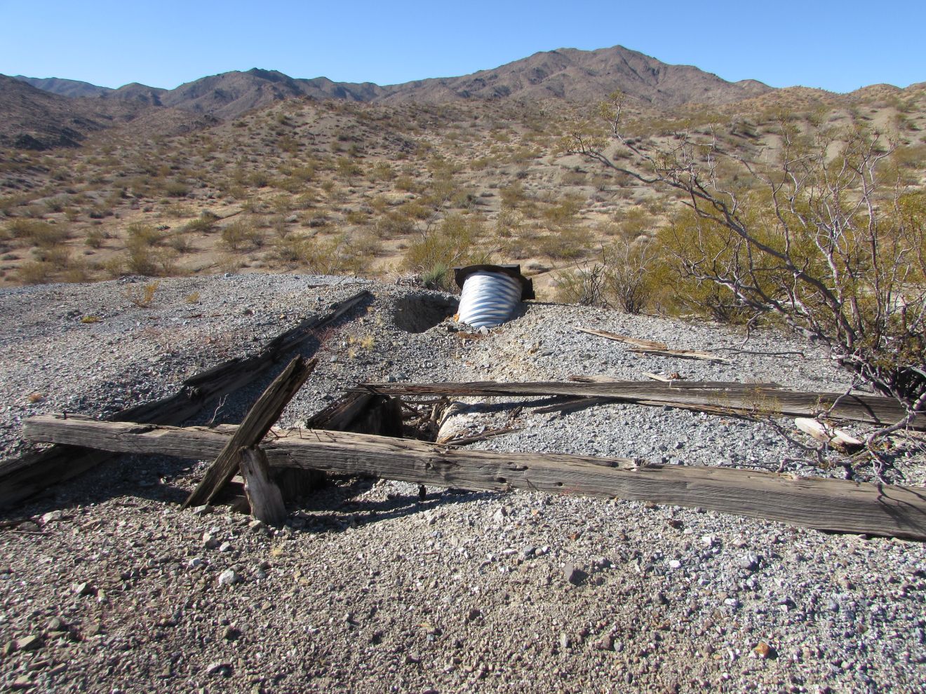
Monday, we drove back to Cal-Nev-Ari for another mine hike.  The target today was the Roman Mine.  We would then have done both the Roman and Empire Mines down the same road.  From the junction we parked at to do the Empire Mine, we headed south for about a mile before we looked for a spot we could turn the truck around.  We did have to park on the road, but there was plenty of room for vehicles to pass. That turned out to not be an issue, as we didn't see anyone else the whole time we were there. Not even a rabbit, and very few birds.  About another mile down the road, we came to another junction, where we could have parked. 
From here, we headed east downhill toward the mine.  This mine had quite a large area cleared, but there were no structures left,  only a small opening into the hill.  We are not sure whether they found anything worth clearing the amount of rock that was pushed out.

Back up the hill a bit, we found what looks like a couple of water tanks covered by a sun shield.  We had our lunch near there.  This hike was 5.8 miles in 3 hours, so much easier than the day we did Empire Mine.  We climbed to 150 feet to the junction, then down about 300 feet , and up 85 feet to the mine.

Thursday morning, we got quite a bit of rain again.  We walked north along the river, and quite a few areas had silt run across the pavement.   We didn't take the camera with us, which was unfortunate as we saw a couple of ruby hummingbirds sipping the nectar from a bush.  We also saw another, or maybe the same resident roadrunner.

Thursday 21 November 2019

Week ending Nov 21, 2019 Laughlin

After resting on Thursday, we walked above the RV park across to Harrah's corner, then back down to the Colorado Belle Casino, where we had lunch at Pint's Brewery.  Joan tried their Rehab Red Ale, which wasn't bad. It's tough to find red ales down here.      She made a meal of potato skins without the bacon.  John opted for a root beer float and had the Greatest Grilled Cheese Sandwich Ever.   It had a few unusual ingredients like peppers.  It was quite tasty, although a bit strong on the peppers.  As usual, the orders were large enough to take half home for later.  Our walk was about 4.7 miles, so fits in our 5 mile walk.  It had a bit of elevation as well, so lunch was a nice break.

Monday, we finally walked across the river, then up towards the dam to Camp Davis County Park, which stretched north from the bridge to the dam.  We discovered that the entrance is at the north end at the traffic lights, and that the closer entrances are only used for emergencies.  We chatted with the staff, and found out that we can't get to the dam through the park.  We had considered walking up to the dam and across to the west side.  Apparently that might be possible by next year to do that.   We saw a roadrunner by the office.  It is there often.
We walked down to the river, along an exhibit for petroglyphs, describing the native Mojave people.
The park ends where the boom is across the river, preventing water traffic to the dam.     When we got back to the bridge, there was a fisherman almost underneath trolling with his motor set just enough to match the current. 
There appears to be an expansion to the bridge across the river here.  They have started the frames for the supports.

We went to the booth for the London Bridge Jet Boat tours, and booked a trip for Friday, since they didn't have any people (of the 15 they need to do the trip) booked for Thursday.  Then we stopped at Aquarius Casino where Joan found a visor for those days when we are in the sun longer than a few hours.  We had milkshakes at McDonalds, the first one we have found in the area that has a machine working.


Tuesday, there were flash flood warnings for the area.  In the evening, we had a thunderstorm, which took our satellite signal just below adequate for a picture off and on.   This continued into Wednesday, with heavy rain again in the evening.   We managed to do a few walks around the park, but put off a hike to another mine.


Thursday was cloudy again, with a few afternoon showers.  We walked along the Riverwalk before they started.   There was gravel washed down onto the sidewalk from the slopes above.  One local commented that there was 3 months of rain in the last 24 hours. 

We plan on spending another week, from Sunday,  here to get stuff ready before heading south to Yuma area.

Thursday 14 November 2019

Week ending Nov 14, 2019 Laughlin

Friday, we walked along Casino Rd up to the entrance road to Harrah's Casino, the last one on the strip, and the only one the riverwalk doesn't reach.  From the entrance, it is 93 steps on the staircase down to the casino.  After wandering through the casino, checking out the food outlets, we chose to walk back up the road rather than using the staircase, making the grade much better. 

Pinty's curling on Saturday.

On Sunday, we went to the office to pay for 2 more weeks, until Nov 24.  Then we watched CFL playoffs, Pinty's finals and the MLS Cup.

Monday, there was a wind warning from 10:00 AM until 7:00 PM.  However, it was warm early, so we walked out toward the dam again.  Saw a couple of roadrunners pose, but we had decided not to carry the camera.  Tried to get picture with the phone, but it is too difficult to see with the glare.

Wednesday we finally decided the weather was good enough (wind quiet enough) to head out to Empire Mine.  It is above Lake Mohave east of Cal-Nev-Ari.  It is about 10 miles east of the village on Loran Station Road, then Empire Wash Road.  We weren't sure how close we could get to the mine with the truck.  About 7 miles in there was a junction where we could park, and the road further looked like we would need somewhere special to turn around.  Not knowing the road, we decided to stop there.   There was a building off the road about where the hardtop ended.   From where we stopped the mine was just over 3 miles, as the crow flies, so we figured it would be about 4 miles each way.  A couple of guys drove past us shortly after we started walking.  We passed their truck parked on a wider area of the road less than a mile away.  From the topo maps, it looked like the route didn't have a lot of elevation.  That was a mistake, since the road worked down through a wash, which was quite soft slogging in places. We learned to walk on the edge where the vehicles (ATV's we presume) hadn't stirred up the sand.

We saw a few hares that we spooked.  Only a few birds.  We did have one large spider cross the road ahead of us.   We figure it was a tarantula, a first for us.

Large Spider
We did a small detour to Potential Mine.  It had several culverts into the mine with bars over them.   We haven't seen these anywhere else.

Potential Mine

Then we walked through the narrow point of Empire Wash.
Ridge along Empire Wash

Shortly past this, a side road heads up to Empire Mine.

Joan stopped at the lower shaft of Empire Mine,
Lower mine entrance
while John did the switchbacks, up to the higher mine site.   It doesn't look like many people visit this site, as the switchbacks were overgrown with low bushes, and barely wide enough for burros, never mind vehicles.  That might have explained the old truck.
Truck over the edge
what's left of mine structure
Lake Mohave from Empire Mine
The distance to the mine was 4.8 miles.  It took us 2h30m to get there.  Our ascent was 600 feet and total descent was 1200 feet.  The climb from the wash to the mine was 313 feet in .5 mi.

After about 1.6 miles back, Joan was tiring out and needed an extended rest, so John left her there to rest under a bush in the shade, while he returned to the truck.  He was pleased to find we had left several 2 liter bottles of sprite zero in the truck, as we had only taken 2 liters of water with us.  He drove the truck back about a mile to the furthest place that looked navigable, then walked back about .4 miles where he met Joan coming up the hill.  We returned to the truck, got it turned around.  

We arrived back at the truck at 3:13 PST.   We had started at 9:08, so this was over 6 hours.  Definitely longer than we had planned.  Note: no more hikes more than 6 miles, and take some food with us, even if only a few apples and granola bars. 

We stopped at the Chevron at the junction of highway 95 and 163 to enjoy a treat of ice cream, since we had only had a few werthers since breakfast.

Thursday 7 November 2019

Week ending Nov 7, 2019 Laughlin

Friday - wind was down a bit, so we walked most of the way to Davis Dam.  Saw a couple of roadrunners and a bunny.  Very quiet on the path.

Saturday, walked past where we stopped yesterday and looped around over the hill on Horsehoe Loop.  Another bunny, but no roadrunners.  About 8 mi.

Sunday morning, we walked across the river to the IHOP on the Arizona side.  Our plan was to watch the final tennis match in Paris between Shapovalov and  Djokovic, but with the end of day light savings time, we only saw the last game.   Nascar playoffs in the afternoon. 

Joan's computer charger wasn't working, but it was compatible with John's, so we would swap it back and forth as required.  On Monday, we picked up a new charger.  We had a choice between a 90 and a 45 watt chargers with various plugs, and figured we would get the higher rated one.  It turned out to be a bad choice, so on Tuesday we returned it.  We brought Joan's computer with us and were able to convince the person in the entertainment area to find a place (not easy) to plug in the 45 watt charger and make sure it worked.   Fortunately, this one did work.

Wednesday we did the 6.6 mile desert loop hike, which climbs west through town, then beside the highway before crossing through an underpass, then north toward Davis Dam. 

Thursday morning, we walked back toward Davis Dam long the river pathways.  This time we did the Contractors' Camp Interpretive Trail.  The Camp was used when the Davis Dam was being built in the 1950's.
fireplace

One thing it had, which surprised us, was a swimming pool.  The pool is filled in, but the concrete around it is still there.

We continued on toward the dam.  There is a gate across the road that runs beside the pathway.

How many keys would it take to unlock the gate?
South of the dam were a few old concrete structures we checked out.  It turned out there must have been a railroad there.   

Below the dam, on a wire across the river, there was a line of about 30 cormorants perched watching for fish in the river, we presume.   They are usually there, but today we had our camera with us.
We heard a song bird in a bush, and were lucky to get a picture of it.

We stopped a while later for a rest, and were amused watching a little red ant moving a bit of something that was bigger than it was.   Every once in a while the bit would roll over, and the ant would flip around with it.