Not too much happening this week.
We moved from Rolling Hills to Arrowwood on Monday. Then we went into Calgary to have supper with Trev and family, and caught up on their activities.
We have been doing some inside and out trailer cleaning.
Next Monday, we move to Vulcan for 3 to 4 weeks, so it will be routine, since we have been there many times.
In mid-September we will be heading back to Edmonton to visit family.
We bought our medical travel insurance for the winter, planning to head south on Nov 1.
We will not be posting a blog until then.
Thursday, 17 August 2017
Thursday, 10 August 2017
Week ending Aug 10, 2017 Empress to Rolling Hills
The playground at Peter Fidler Park doesn't get a lot of use.
On Friday morning, we walked up to town past the Empress Station Museum, which has tours on request.
Our first stop was at That's Empressive to check out the diesel situation. They have a couple of fuel tanks beside the store. They are open long hours, 7 days a week, so not a problem.
After a short chat, we got assigned a 'Charlie's Angels' mission. Our task is to go and check out the old ferry landing to make sure it is in order. It is reputed to be a beautiful location. Then we asked about whether we could drive to the forks of the Red Deer and South Saskatchewan, which is about 10 km on the east of the border. We got detailed directions to get there, and advised us about a couple of attractions on the way. We carried on around town. On of the yards has a few flags on its corner, and elaborate landscaping. We saw a lot of rabbits around town. They are very tame. Empress's nickname is the 'Hub of the West'. One of the websites says that it is at the geographic center of the area between Calgary, Edmonton, Saskatoon and Regina. Basically what that says to us is that it is the furthest place from a major city between these cities.
Saturday we headed to the forks of the Red Deer and South Saskatchewan. We went north across the Red Deer, then east into Saskatchewan until we got to the sign for the Estuary Ferry. After waiting a few minutes for a vehicle to be brought from the south side, we, and another truck, took the ride south.
On the south side, we headed back west through the hamlet of Estuary to a Hutterite colony. Our route went along the side of the colony's fields, and then climbed up onto the old railway right of way. We continued along the right of way until we got to a field with horses grazing, overlooking the forks.
We returned the way we had come until we got back to the east west road on the north side of the river, then went about a km east to Sagebrush Studio and Art Galleries. They say you can make an appointment between 1 and 5, or you can take your chances dropping in. We got lucky, and met Dean and Fran Francis. Dean took us through the two galleries, which are beautifully set up in two churches which he had moved to this site, and restored for displaying their art. He also moved another church which they use for their studio.
They have also done an excellent job of landscaping their yard. See their website for examples of their art and more information.
On our way back to Empress. we drove down to Forks Praire Orchards. There is supposed to a be a u-pick there, with raspberries and strawberries, apples. They actually developed a new apple for the University of Saskatchewan. However, we didn't find anyone at the house, or the orchard area. On the way back out, we came stopped at a picturesque homestead.
In the afternoon, we undertook our mission to find the old ferry site south-east of Empress. We followed the directions we got at That's Empressive, and arrived at the old ferry that had been pulled out of the water and up the hill to a bench. It is has been scavenged somewhat for lumber, but still has a lot of the structure. A bunny is using it for shelter.
We walked down to the river, and saw a double canoe go north on the South Saskatchewan.
At the riverbank, we encountered a young family fishing in the river. They pointed out a bald eagle up on a ledge above the river. There had been another one with it earlier.
A couple more double canoes came down the river.
Back in Empress, we returned to That's Empressive to get diesel. We chatted for a few minutes with the lady that owns the store, who was preparing something for the little bistro they have there. We also found out we were lucky to get diesel, as a woman came to get gas, and the gasoline side of the pump is not working.
On Monday, we packed up and went to Medicine Hat. We picked up a bunch of stuff at Costco, Walmart and Safeway. After having lunch at IHOP, we headed west along SR 524 toward Rolling Hills (south of Brooks). While we were getting setup, trying to decide on a site, a fellow with a flatbed trailer loaded with tables pulled in. He was returning them from the 100 Anniversary celebration at Scandia. Shortly afterwards, another fellow with a tractor with a forklift bucket arrived to unload the tables. We found out from him that the 'Reserved' signs at many of sites were out of date, so we could have any site we wanted. There are only about 4 sites that are long enough for us, although the road in front of the sites is quite wide. We actually backed into 3 sites before we settled on one.
On Tuesday morning, we put our golf clubs on our hand carts and walked to the golf course on the other corner of town (about 4 blocks). Additionally, the golf course is one of the places, besides the ATB agent, where we could pay the campground fees. The woman there had never done campground fees, so she didn't know whether there was a weekly rate, so she checked with her manager, who didn't think there was one. We paid for the campground, and nine holes of golf. There were a couple of ladies getting ready to golf when we went to the first hole, so we asked them to play ahead of us, since we aren't very fast, and they had a power cart. While we were waiting for them to get ahead of us, the lady from the golf course desk came out to us. The fellow who was at the campground with the tractor on Monday was finishing breakfast, and told her that there was a weekly rate, so she brought the difference to us at the first tee. The golf course is a pretty course, There are a lot of trees along the fairways, and a few strategically located on the fairway. John managed to hit quite a few of the trees. Additionally there is a channel about 4 feet wide that runs through the course, and we both managed to get balls into it a few times. Joan even lost a ball in it on the 9th hole. We decided to have lunch in the clubhouse, a couple of mozza burgers with fries. We caught up to the two ladies that golfed ahead of us and chatted with them while we had lunch. When we went to pay for our lunch, we were informed that the lady that we were chatting with had paid for our lunch. That was a first!
Wednesday, we did a tour in the area, starting with Scandia, west of Rolling Hills.
There is a museum there which looked like it has the usual old agricultural stuff in it. More uniquely, it has a row of rocks, each of the name of one of the towns in the area painted on it. There is also the first elevator in Alberta which was made a historic resource.
The Honey Company has a big plant across from the museum. Then we headed south to Vauxhall. We reminded ourselves that the Lions Campground there has limited services, no 30 amp power which would be necessary to run our air conditioner. Then we picked up some beer. We hadn't done that in Medicine Hat's Costco, because their smallest amount of our type of beer was 48 cans. We also cashed in our water bottles, that were filling up our recycling bin, and disposed of the majority of the other recycling in the bins at the depot. From Vauxhall, we headed east to Hays. We took a quick look at their campground, which has 30amp power, no water. Then we looked for a walking trail we had seen a reference to on the internet. We decided it must be between the rows of trees that form a square around the town. Then we decided we should check out secondary highway 525, which starts east of the Bow River Bridge east of Hays, and parallels the river northwest into Rolling Hills. It is a good gravel road through cow grazing country.
When we got back to the trailer, we checked the town website and found the library was open from 1:30 to 3:00, so we headed over there. The librarian met us at the door, as the hours we saw were not the summer hours. However, she was doing some work, so let us come in and use the wi-fi to bring our computers up-to-date. We started downloading updates, which very slowly showed progress , creeping from 0% to 1% to 2%. After a while we decided we would have to be there all night at that rate, so headed back to the trailer. Then we went over to the Farmers' Market at the arena. We picked up a bag of new potatoes, and a loaf of whole wheat bread.
On Thursday, our plan was to go to Brooks to Dairy Queen since it was their Miracle Treat Day, with proceeds going to the childrens' hospitals. We stopped at the Brooks Library to finish our Windows 10 updates. After about an hour there, we figured it would take a few more hours to complete, so John found out how to kill the update process. Otherwise, it would use exceed data allowance on our phone plan when we next connected to our wi-fi, which we do several times a day.
On our way back to Rolling Hills, we went to the Brooks Aqueduct Provincial/National Historic Site. It describes the building of the concrete aqueduct which as built by the CPR for irrigation, to attract settler to this area of Alberta. Construction started in 1912, and water flowed through the aqueduct from 1915 to 1979. They had originally planned to cross above the railway mainline, but there wasn't enough clearance. Instead of lowering the tracks, a very expensive process, they built a reverse siphon that ran underneath the tracks, connecting two sections of the aqueduct. The aqueduct only reached a flow rate of 2/3 of the planned capacity. One of the problems was the amount of silt, vegetation and fish in the system. Each fall when they drained the aqueduct, people would gather to catch 'sack after sack of fish' coming out of the drainage doors. In 1979, the aqueduct was replaced by the current two-bank earth-fill canals.
 |
 |
Our first stop was at That's Empressive to check out the diesel situation. They have a couple of fuel tanks beside the store. They are open long hours, 7 days a week, so not a problem.
 |
| That's Empressive |
Saturday we headed to the forks of the Red Deer and South Saskatchewan. We went north across the Red Deer, then east into Saskatchewan until we got to the sign for the Estuary Ferry. After waiting a few minutes for a vehicle to be brought from the south side, we, and another truck, took the ride south.
 |
 |
| Forks of the Red Deer and South Saskatchewan |
We returned the way we had come until we got back to the east west road on the north side of the river, then went about a km east to Sagebrush Studio and Art Galleries. They say you can make an appointment between 1 and 5, or you can take your chances dropping in. We got lucky, and met Dean and Fran Francis. Dean took us through the two galleries, which are beautifully set up in two churches which he had moved to this site, and restored for displaying their art. He also moved another church which they use for their studio.
 |
 |
| Diamond willow arrangement |
On our way back to Empress. we drove down to Forks Praire Orchards. There is supposed to a be a u-pick there, with raspberries and strawberries, apples. They actually developed a new apple for the University of Saskatchewan. However, we didn't find anyone at the house, or the orchard area. On the way back out, we came stopped at a picturesque homestead.
 |
 |
 |
| The bunny that lives in the ferry |
We walked down to the river, and saw a double canoe go north on the South Saskatchewan.
 |
 |
| Bald Eagle |
A couple more double canoes came down the river.
Back in Empress, we returned to That's Empressive to get diesel. We chatted for a few minutes with the lady that owns the store, who was preparing something for the little bistro they have there. We also found out we were lucky to get diesel, as a woman came to get gas, and the gasoline side of the pump is not working.
On Monday, we packed up and went to Medicine Hat. We picked up a bunch of stuff at Costco, Walmart and Safeway. After having lunch at IHOP, we headed west along SR 524 toward Rolling Hills (south of Brooks). While we were getting setup, trying to decide on a site, a fellow with a flatbed trailer loaded with tables pulled in. He was returning them from the 100 Anniversary celebration at Scandia. Shortly afterwards, another fellow with a tractor with a forklift bucket arrived to unload the tables. We found out from him that the 'Reserved' signs at many of sites were out of date, so we could have any site we wanted. There are only about 4 sites that are long enough for us, although the road in front of the sites is quite wide. We actually backed into 3 sites before we settled on one.
On Tuesday morning, we put our golf clubs on our hand carts and walked to the golf course on the other corner of town (about 4 blocks). Additionally, the golf course is one of the places, besides the ATB agent, where we could pay the campground fees. The woman there had never done campground fees, so she didn't know whether there was a weekly rate, so she checked with her manager, who didn't think there was one. We paid for the campground, and nine holes of golf. There were a couple of ladies getting ready to golf when we went to the first hole, so we asked them to play ahead of us, since we aren't very fast, and they had a power cart. While we were waiting for them to get ahead of us, the lady from the golf course desk came out to us. The fellow who was at the campground with the tractor on Monday was finishing breakfast, and told her that there was a weekly rate, so she brought the difference to us at the first tee. The golf course is a pretty course, There are a lot of trees along the fairways, and a few strategically located on the fairway. John managed to hit quite a few of the trees. Additionally there is a channel about 4 feet wide that runs through the course, and we both managed to get balls into it a few times. Joan even lost a ball in it on the 9th hole. We decided to have lunch in the clubhouse, a couple of mozza burgers with fries. We caught up to the two ladies that golfed ahead of us and chatted with them while we had lunch. When we went to pay for our lunch, we were informed that the lady that we were chatting with had paid for our lunch. That was a first!
Wednesday, we did a tour in the area, starting with Scandia, west of Rolling Hills.
 |
 |
When we got back to the trailer, we checked the town website and found the library was open from 1:30 to 3:00, so we headed over there. The librarian met us at the door, as the hours we saw were not the summer hours. However, she was doing some work, so let us come in and use the wi-fi to bring our computers up-to-date. We started downloading updates, which very slowly showed progress , creeping from 0% to 1% to 2%. After a while we decided we would have to be there all night at that rate, so headed back to the trailer. Then we went over to the Farmers' Market at the arena. We picked up a bag of new potatoes, and a loaf of whole wheat bread.
On Thursday, our plan was to go to Brooks to Dairy Queen since it was their Miracle Treat Day, with proceeds going to the childrens' hospitals. We stopped at the Brooks Library to finish our Windows 10 updates. After about an hour there, we figured it would take a few more hours to complete, so John found out how to kill the update process. Otherwise, it would use exceed data allowance on our phone plan when we next connected to our wi-fi, which we do several times a day.
On our way back to Rolling Hills, we went to the Brooks Aqueduct Provincial/National Historic Site. It describes the building of the concrete aqueduct which as built by the CPR for irrigation, to attract settler to this area of Alberta. Construction started in 1912, and water flowed through the aqueduct from 1915 to 1979. They had originally planned to cross above the railway mainline, but there wasn't enough clearance. Instead of lowering the tracks, a very expensive process, they built a reverse siphon that ran underneath the tracks, connecting two sections of the aqueduct. The aqueduct only reached a flow rate of 2/3 of the planned capacity. One of the problems was the amount of silt, vegetation and fish in the system. Each fall when they drained the aqueduct, people would gather to catch 'sack after sack of fish' coming out of the drainage doors. In 1979, the aqueduct was replaced by the current two-bank earth-fill canals.
 |
| One of the two sections of the aqueduct at the site |
Thursday, 3 August 2017
Week ending Aug 2, 2017 Huber Dam to Empress
This week we basically hung around the campground. The weather was good, so we did a walk around the campground, and out to the grid road and back, which took us about an hour.
On Monday, we were on our way to Stettler to pick up some items we couldn't find locally when we got a call from McKenzie Motors that the fuse box for the truck had arrived. We went into Coronation after lunch, and it only took them a few minutes to install it.
On Wednesday, we packed up. We had a problem running in the bedroom slide, and found that John hadn't moved the air purifier to the end of the bed. Then we headed to the campground in Castor to empty our tanks. On our way south of Castor on Highway 36, we were stopped by a flagman to tell us to get off the highway as soon as we could as they were moving a house that was taking almost the whole road, and if we couldn't get off before we got to it, to move over right to the edge (and hope the house could get by?? ). Fortunately we came to a farmyard before we encountered the house. Joan drove into the yard where there was enough room to turn the trailer around, and returned to park on the driveway leaving enough room at the entrance in case someone came home before we could leave.
After the house went by, we carried on until we got to the Cactus Corner Truck Stop at the junction of Highways 36 and 9 for brunch. Then we headed for Peter Fidler Park in Empress on the banks of the Red Deer River near where it joins the South Saskatchewan. We are back in antelope country, seeing a couple of groups south of Oyen on highway 41. When we were setting up in the park, Joan found that the TV in the bedroom had fallen off the dresser where it sits. John didn't put it on the bed where it rides when we are travelling. Fortunately, it works fine still.
Once we got setup, we drove into Empress to find the Village Office to pay for camping until Monday. After doing a loop around town without any luck, we stopped in at That's Empressive, a variety store. We had seen it on the Village website as an alternative when the Village office is closed. The operator said that he took payments on Mondays. He gave us directions to the office, just around the next corner. We found the appropriate building, and figured out why we missed it. It's most prominent sign was ATB Financial. However, in lettering with much less contrast, it did say that it was the Village of Empress Office. Apparently we aren't the first people that have had this problem. It's the first time we have been in a Village Office, where their counter is right next to the counter for ATB.
Peter Fidler Park has 10 full service 30 amp sites for only $22 / night.
On Thursday morning, we decided to do the 3.2 km figure 8 loop around the park. We are not quite sure what they were describing, as we didn't find a trail that was in a figure 8. We primarily followed the roads in the park, but had to off-road to get to a few interpretive signs. A lot of the signs were missing, and others were a somewhat water-damaged.
 |
| Sunrise through the smoke |
On Monday, we were on our way to Stettler to pick up some items we couldn't find locally when we got a call from McKenzie Motors that the fuse box for the truck had arrived. We went into Coronation after lunch, and it only took them a few minutes to install it.
On Wednesday, we packed up. We had a problem running in the bedroom slide, and found that John hadn't moved the air purifier to the end of the bed. Then we headed to the campground in Castor to empty our tanks. On our way south of Castor on Highway 36, we were stopped by a flagman to tell us to get off the highway as soon as we could as they were moving a house that was taking almost the whole road, and if we couldn't get off before we got to it, to move over right to the edge (and hope the house could get by?? ). Fortunately we came to a farmyard before we encountered the house. Joan drove into the yard where there was enough room to turn the trailer around, and returned to park on the driveway leaving enough room at the entrance in case someone came home before we could leave.
 |
| House moving with a semi parked on a grid road waiting for it to go by |
Once we got setup, we drove into Empress to find the Village Office to pay for camping until Monday. After doing a loop around town without any luck, we stopped in at That's Empressive, a variety store. We had seen it on the Village website as an alternative when the Village office is closed. The operator said that he took payments on Mondays. He gave us directions to the office, just around the next corner. We found the appropriate building, and figured out why we missed it. It's most prominent sign was ATB Financial. However, in lettering with much less contrast, it did say that it was the Village of Empress Office. Apparently we aren't the first people that have had this problem. It's the first time we have been in a Village Office, where their counter is right next to the counter for ATB.
Peter Fidler Park has 10 full service 30 amp sites for only $22 / night.
On Thursday morning, we decided to do the 3.2 km figure 8 loop around the park. We are not quite sure what they were describing, as we didn't find a trail that was in a figure 8. We primarily followed the roads in the park, but had to off-road to get to a few interpretive signs. A lot of the signs were missing, and others were a somewhat water-damaged.
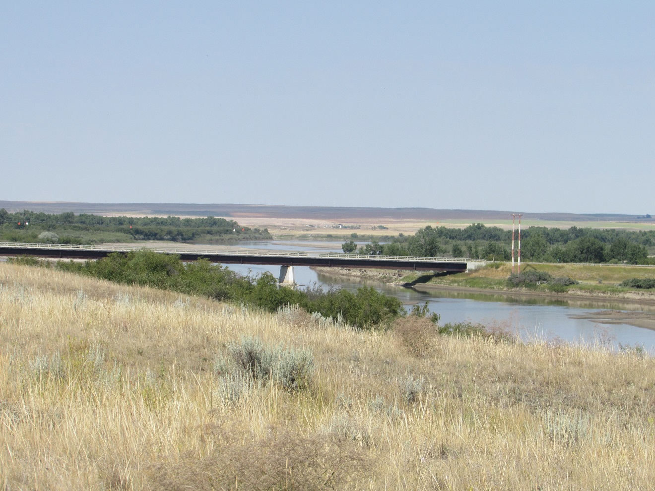 |
| Bridge across the Red Deer River |
 |
| Sand bars on the Red Deer River |
Subscribe to:
Comments (Atom)