Thursday 23 February 2017

Week ending Feb 23, 2015 Wickenburg, Vicksburg

Friday we went into Wickenburg to the Desert Caballeros Western Museum, which celebrates Wickenburg's distinctly old west flavor.  The main floor of the museum was dedicated to western artists, with permanent displays including pieces by Remington and Russell.  There is also a featured artist display.   On the lower floor, there are some well done period displays of both rural and urban homes.  There are also some dioramas of wildlife.
On Saturday, we went to the Vulture Mine, which opens its gates between 9:30 and 10:00 am Saturdays only for a 2 hour guided tour of the mine site.    While we waited for it to open, we chatted with two couples from  Okotoks in the next car.  One of the ladies mentioned that sometimes they close if it is raining, as the roads and walks around the mine are dirt.   It had rained overnight, and was still overcast, but only sprinkling occasionally.    By 10:10, we hadn't seen any evidence of anyone coming to open the gates for the tour, so we left.   It would have been nice of them to put up a sign if they weren't planning to do tours today so we wouldn't have to wait 45 minutes for nothing.   On the bright side, the drive out to the mine, 12 miles south of Wickenburg, is very scenic.   There are lots of trailers boon-docking in the blm area along this road, and a trail to Vulture Peak, so we may return here another year. 

Saturday night and Sunday were quite rainy.  The first few rows of the RV park are tiered.  To prevent water from running down from our tier to the one behind us, they have a ridge about a half a foot high. Consequently, it creates a bit of a ditch  along the back of the site, which has a few inches of water in it.  We spent the day inside doing some cleaning, and watching the Scotties.

Monday, we headed for the BLM land in Vicksburg, and found a better site than we had last time we were here, a shorter walk to the hills.  

On Tuesday, John looked at the points of interest near here using the Arizona topo map, and created a  3 mile route to take us from below 1600 ft elevation to the Black Cat Mine at 1840 ft in the hills toward the east.   We followed the route across a series of washes to a point where the railway is against the edge of the hills.   We walked along the track a short distance, but left it for an atv trail (which happens to be Black Cat Pass Road), because the tracks ahead were over a wash, and we didn't want to be caught where it would be difficult to get off.   Good choice, as shortly after that, a train came by.  
Arizona and California Railroad
We continued on that trail until we got to the point where our route headed up a wash into the hills.  Shortly after we rejoined our route, we saw a group of about 10 atv's heading down the wash, then up a trail to the south.  We carried along a bit further, and noticed some concrete structures, where 2 more atv's were parked.   We got to the structures, which were leaching tanks for the mine.  Then we followed the atv trail, which wound along the hill up to the mine.  A couple more atv's met us on our way up.   We had walked just over 4 mi when we got to the mine.
Black Cat Mine shaft
After looking at the tailings pile and the boarded over hole for the mine, we returned to the leaching tanks where we had lunch.    After a break, we walked back down the wash.  Rather than continuing further down to Black Pass Road, we decided to head over a shoulder between a couple of hills, a more direct route back to the trailer.   That section wasn't too bad, but when we got over the shoulder, we started having to go down and up through washes.  After slogging through a few of these, we rested for a bit in the shade of a pile of ties beside the railway.  Then we crossed the railway to an atv trail beside the tracks.  We followed it for a while, as it was much easier walking, but then the railroad and the trail turned away from our route back.    Once again we were having to walk along wash edges to found a reasonable way down one side and back up the other.  Joan was starting to feel tired, due to the roughness, and the heat (about 26c) so we found a nice tree to sit under, next to a road.    We still had just under a mile back to the trailer, with more washes to cross, so John decided to head back to the trailer and bring the truck back to pick Joan up. 

John drove up the road we were parked on , and then across toward the road Joan was at.  However, the road turned into more of an atv trail, and after going through one wash where first the front of the truck scraped and then the back, and then got to another steep drop, where the trail followed an 'intermittent stream', decided to return to the trailer, and walked back to where Joan was.  It's nice to have the GPS to mark places like this to find them again, rather than trying to remember the shape of particular trees or saguaros nearby.   When he got back to the location, Joan wasn't there anymore, but was just in site along the road.   She had laid down for a short nap under the tree, and when she woke up, was refreshed.   She decided to walk up the road  (which didn't go much farther in the other direction).   Fortunately, she was still in sight,  so we got together, then headed back to the trailer.   Our 8 mile hike took us from just after 9 until about 4:30.   Quite an adventure.  It was sure nice to sit in the shade of our trailer enjoying mugs of cold coffee.   We both got a bit of sunburn, as we don't where hats.  This is the first time we have actually separated like this on a hike, so we learned some valuable lessons. 
- taking half an hour to recover is better than splitting up.
- don't assume that just because an atv trail is marked as a road on the GPS it is the same all the way.   Check the whole route of the road to see where it goes.
- if you do have to split up, have a pen and paper to leave a note if you decide to move.
- this is one case when having two phones would have been really useful.

The desert is relatively moist this year.
Prickly Pear Cactus with buds


Moss in the desert

Ocotillo with actual leaves
 Wednesday we decided to do a shorter hike, to check out the road to where Joan was yesterday.   We walked the mile over to where she was on the 'road' when we came across to the trailer.  The total distance was 4.4 mi, but only took 2 hours, since most of it was on a track, instead of scrambles.  Even though the truck could have gone past where John turned it around, there were some really difficult spots where one side of the road was quite a bit higher than the other on slopes into washes. 
Wash that the pickup scraped across
Thursday morning, after a windy night was quite cool in the trailer (55f).  We drove into Parker to get some stuff and post the blog.

Thursday 16 February 2017

Week ending Feb 16, 2017 Congress Prescott Wickenburg

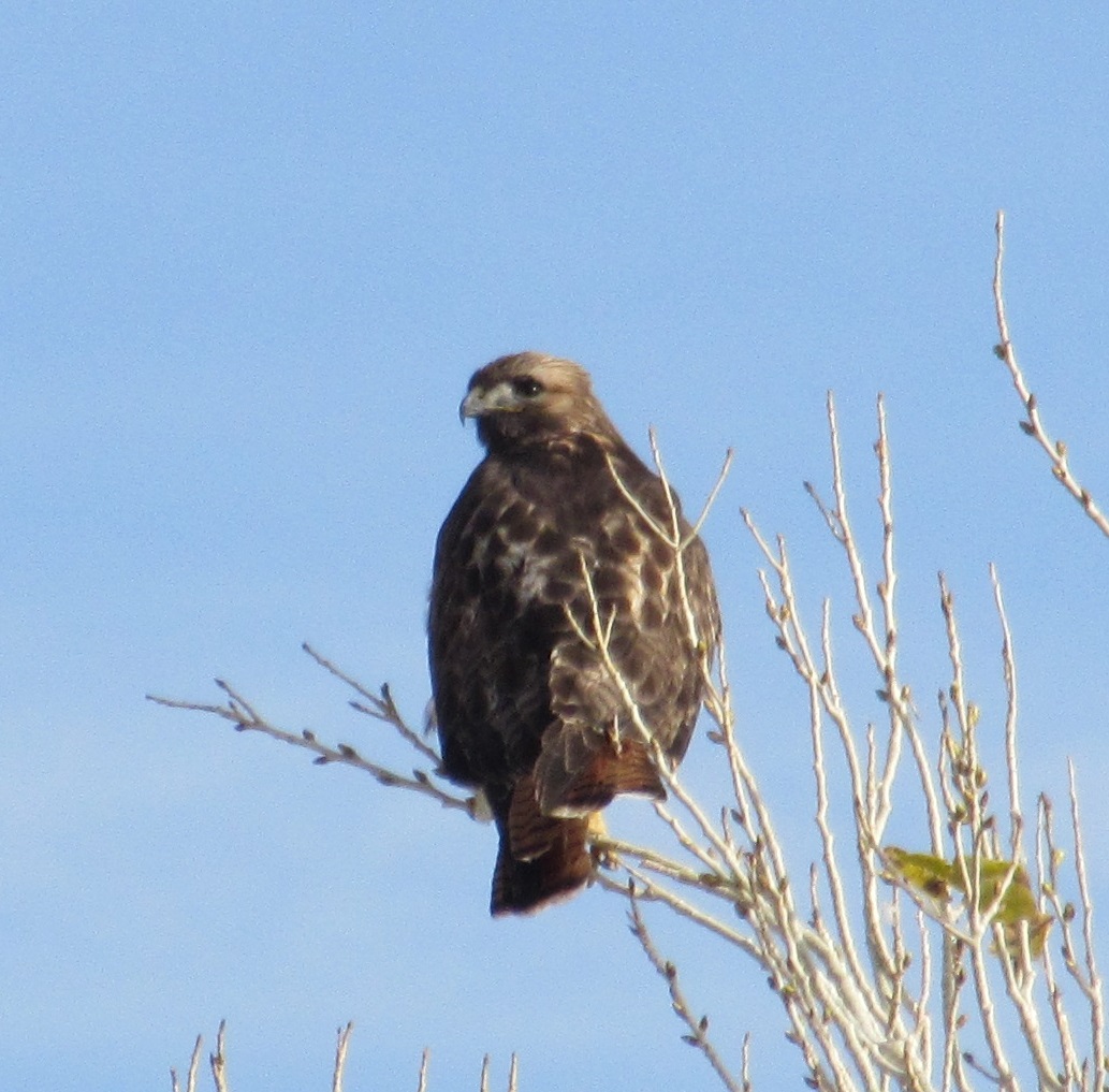
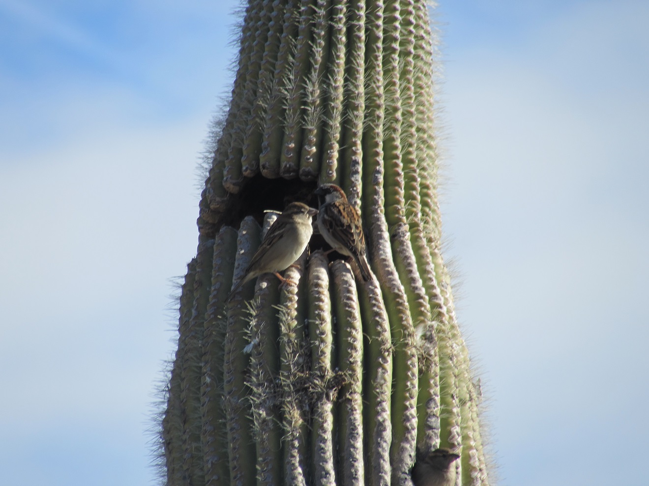
Friday morning we decided to head to 'big tank', a point of interest marked on the Arizona GPS Topographical Map about  2.7 miles from the back gate of the park.    We saw a couple of woodpeckers on a cactus on our way to the gate.  

We followed an ATV trail which had signs indicating direction and distance to various points (not including the big tank).  We headed east to '4 corners', then south to 'Inspiration Point', then a bit over to 'Assay Road', which the etrex showed as Burnt Sage Road.   We were about 2.5 miles out at that point, so we decided to return along Burnt Sage Road toward the highway.    We thought the area looked good for boon-docking,  and shortly saw a short side route to a firepit.  Just after that, there was a BLM 14 day camping sign.    It might be a good place to camp in the November or March (the elevation is about 2700 ft here).  About halfway back, we came to an ATV trail heading back toward the RV park.  Our route was about 4.6 mi. in total.  We only saw one ATV on the route, but there was lots of evidence of people having hiked the route  previously.   We saw a couple of hares en-route.  Back near the park, we noticed the desert golf course, and even saw a couple just coming off the course. 

On Saturday, we took Highway 89 north through Congress (el. 3036 ft), then up over the Weaver Mountains  past Congress through Yarnell (el. 4780).   At Kirkland Junction, we stayed on 89, instead of heading around the Bradshaw Mountains as the GPS recommended.    It soon became obvious why the other route might be faster, as there were many 20 to 25 mph corners as the highway wound its way through the mountains.  We peaked at 6000 feet  before winding down to Prescott, Arizona's mile-high city at 5300 ft.  The drive through the Prescott National Forest is quite beautiful, with  a bit of snow on the north faces of some of the hills.    Once in Prescott we picked up the walking tour guide for downtown ($1).  Most of Prescott was rebuilt after a devastating fire on July 4, 1900.    There are some nice buildings on the tour, and a few others that weren't on our list.  We walked along at a good pace as it was only about 14C, the wind coming off the hills had a bite to it, and Joan had forgotten to bring long-sleeved top to put over her short sleeved shirt.   
Worlds Oldest Rodeo  1888

Hassayampa Inn


After a bit of shopping and some sandwiches, we took the long route on County 10 which the GPS had recommended.  It went over a 6014 ft. summit just above town, then followed a ridge slowly down into the Skull Valley, where we came to the BNSF RR route that goes past our RV park.  It doesn't go over either range of mountains we did going to Prescott.  When we got the end of County 10 in Kirkland, we headed west toward Hillside. From Hillside, we could have taken Date Creek Rd, which is a gravel route going along the BNSF route toward Congress.  However, we wanted to go to Bagdad, so we headed northwest on Highway 96 the full 22 miles of its route, ending in Bagdad.   About halfway to Bagdad, we crossed the Santa Maria River, which has water in it.  There were people boon-docking along the river.  There are a couple of large copper and gold mines in Bagdad (pop about 2000) which are still active.   We couldn't any signs to the Bagdad Museum (marked on our back-roads map) or a visitor center either on the GPS or on any signs in town.
Tribute to mine workers

We headed about 10 miles west to Highway 93, the Joshua Forest Parkway of Arizona, which goes from Phoenix to Kingman, then on to Vegas.  Along the way we saw a lot of people with pickups that looked like they might be hunting.  (need to check when hunting season is in this are).    We also saw these signs, which made us wonder what it would be like if the water flooding the road ever froze.
Interesting combination

At highway 93 north about 6 miles  looking for Nothing, another marker on our backroads atlas.  We got to the call box marked in the atlas, and continued a bit further up the highway, and lo and behold, we found Nothing, a deserted gas station site. 


Time to head back to the trailer, through the Joshua trees along the highway. 

Sunday was drizzly, and then thundered overnight.

Monday, we drove to the Hassayampa River Preserve only to find out that it is only open from Wednesday to Sunday.  Who figured?!  Guess it makes sense that they would have two days off during the week instead of the weekend.

Tuesday we went to the Granite Mountain Hotshots Memorial State Park which commemorates a group of 20 fire fighters 19 of whom died when a fire turned back and trapped them on Yarnell Mountain in 2013.    The park opened last November.   
See www.granitemountainhotshotsmemorial.org for profiles of the hotshots who died, and https://en.wikipedia.org/wiki/Yarnell_Hill_Fire for a description of the events of the fire.

The crew
The 2.55 mi one-way trail climbs from highway 89 (west bound lane) between Congress and Yarnell from an elevation of 4318 to 5640 feet behind Glen Ilah and Yarnell.   About every 600 feet there is a plaque commemorating each of the fire-fighters who died in this tragedy.

One of the 19 plaques along the route
The boulder structure of these granite mountains is quite interesting.    The trip took us just over 5 hours as we knew it was climb and didn't want to wear ourselves out too quickly.   It was cool when we started but we quickly warmed up, and then the sun came out.  We enjoyed lunch on the bench at the overlook of the memorial, at the top of the trail.  We opted not to go the 750 ft down to the memorial behind Yarnell.  

We had seen a sign on our way through to Prescott that there is no access to the memorial through town.  Somebody with private property must have gotten tired of people going across their land to the memorial. 
Memorial
Regardless, it was a very nice hike up through the boulder fields.   On the way down, we encountered a State Parks employee who turned out to be the manager of Alamo Lake State Park, about 50 miles east of here.   He told us that the point we met at had become a spot for para-gliders to use once the Parks built the trail.  He also told us that there was a mountain lion who patrols this area, as well as numerous Arizona green rattlers, who were not out now as it is still too cold.    The scenes of the valley were amazing, from the dairy farm below the highway, to Congress, the RV Park, and even Wickenburg.  On the other side of the hill, we could see Yarnell, Peeples Valley and Wilhoit all which we saw on the way to Prescott.  
Some of the many charred trees

We climbed up to the bench above then around the hill it was on

View of the trail on its way to the bench

View of the valley below the trail
The actual memorial is in the valley below the hill.  We opted not to walk down the 400 ft of elevation, after having climbed up 1000 feet already. 

On the way back down the trail we saw a little white butterfly with black and orange tipped wings.  We were only able to get a picture of it while it sat on a boulder with its wings closed.   It would have been nice if it had spread its wings while sitting there.
 Wednesday we went to the Hassayampa River Preserve, ($5 each).  It is a beautiful little oasis in the middle of the desert where the river actual runs above ground.  The Preserve has a little lake in it.  We walked  about 3 miles of trails, along the river, up to a viewpoint from a little hill, and around Palm Lake.      We sat on the bench at the end of Palm Lake watching a Vermillion Flycatcher flit about.   Quite a contrast from walking up the hill to the firefighter memorial.

 River Ramble loop

Cottonwoods with leaves starting  - from  the lookout

Palm Lake
Vermillion Flycatcher
Hummingbird feeder

On Thursday, we did a 6 mi walk east of the RV park, wandering past Lonesome Saguaro, truly the only saguaro in sight, then down into the St. Martinez Wash at a cairn.  From there we followed the wash south until we got to Burnt Sage Road.  We walked up Burnt Sage Road almost to the highway, to see what the road was like, as there was BLM 14 day camping allowed along the road.
Near a water tank, we saw another reminder that you cannot camp within 1/4 mile of a water source, due to wildlife use.   We saw 2 different tanks along the road, and occasionally, could see the narrow pipeline that runs from a large tank near the highway, all the way out to a tank in the valley close to the wash.  Close to the highway, we followed an ATV trail which petered out.  We worked our way across to a trail we were on last week, only to encounter a steep wash.  When we found a spot to get into  the wash, we noticed footprints going up the wash toward the RV park. That worked fine until we got the barbed-wire fence on the edge of the RV park. 

Thursday 9 February 2017

Week ending Feb 09, 2017 Buckeye Hills to Wickenburg


Early Friday we went to Robbins Butte Wildlife Area in the Gila River valley, about 6 miles north of the Park.   We got one of very few wildlife sightings right at the beginning.

Despite the following sign, there were many shells scattered around the area.

A new use for the pamphlet holder
We walked along the road past the last designated parking area, toward Robbins Butte, which we could see in the distance.  We saw only a few birds, including a hawk looking for a tasty ground squirrel.  After a while, we got to a gate to what we assume is a farm house.  There were signs showing the 'designated access' route around the private area, through some irrigated fields.  Once at the end of these we got to a pond near  the base of Robbins Butte.  Boy Scouts had planted a cottonwood grove near the pond to attract a wider variety of wildlife. 
Robbins Butte
When we got around the base of the butte, we heard a vehicle come up and park at the base of the butte, as we were looking for a route to climb to the top.  A couple of guys were looking where to set up a target, so we got their attention.  They were surprised to see someone there, as there were no cars in that area (they would have skirted around the wildlife area before getting as far as our truck).  It turned out that they were from Winnipeg and one of the fellows is a involved in pistol target shooting competitively.  We didn't expect it to be Canadians doing target practice.   They were concerned about ricochets, so we opted not to go up the Butte and told them we would be returning along the road they had come in on. It looked like they might be getting some company as we met a few other vehicles coming in as we were on the way out.  Nearly back at the truck, we came across Robbins Road, which carries from the Regional Park north as an ATV track until it gets to the edge of the wildlife area.
In the afternoon, we joined with family and friends of Don, mentioned in last week's blog who was having an early afternoon barbecue.  We got to meet a couple from Alabama who are staying in the park, and a family from a little island off the west coast of Vancouver Island in the Deer Group of islands near Bamfield who came down from Canada in a rented RV and are visiting with Don's daughter.   

On Saturday, we packed a lunch, took our garbage to the nearest pit toilet location in the park, and then headed through the hills to large open area (similar to Margie's Cove).  We followed a wash down for a while before stopping for lunch.  Then we returned on the south side of the hills back to the trailer, eventually coming across the shoulder of the hill behind the trailer where we had started our hike last Tuesday.  
Rainbow Cactus

Tiny purple flowers
Later in the afternoon Don asked John if he would show his brother where to park his trailer when he arrived in the evening, in case Don didn't get back from dropping his kid's family at the airport in Phoenix.    They arrived around 6pm, in the dark.  We got them parked just before Don got back.

On Sunday, we thought we'd try the Black Bear Diner again, since the last one was being renovated. However, when we arrived, the parking lot was packed, and the hotel next door had signage that a permit is needed a permit to use their lot.  Probably not good timing, trying it on Sunday morning. We had breakfast across the road at IHOP, and quite enjoyed it, despite being disappointed we couldn't give the Black Bear another go.  After breakfast we picked up a hiking pole for John at Cabela's, and then stocked up on a few things before we head out on Monday. 
 
Monday morning we packed up and headed to North Ranch Escapees Park between Wickenburg and Congress northwest of Phoenix.

Tuesday morning we did a walk round the Park.  There are a lot of owned sites, some of them with very nice looking houses on them.  Quite a few sites are for sale.  One units owner had a creative used for pop cans.
The gardening in the park attracts a lot of birds. 

Near the end of our tour, we saw another trailer with a Shaw satellite dish, and a trailer with a High River Autoplex logo.  We got chatting with him for a while.  He lived in High River for 17 years, but had sold before the flood in 2013.  He rents the a site in this park from someone here who owns several sites. They like this location as they enjoy ATVing in the desert and hills in this area.  They had a feeder behind their trailer. 

In the afternoon, John decided to try again to get the lens cover off the light above our trailer door.  He even tried a new method, sticking an awl through the hole in the bottom of the fixture, even though it looked like it was just to drain condensation inside the fixture.   Still no luck, except Joan had noticed an RV tech down the road.   He came by later, and after trying all the usual ways to remove the cover, borrowed the awl and popped the cover off.  John just hadn't pulled hard enough.  Since the cover was cracked, and the tech had recently replaced the one on his trailer with a sensor model, we got a $5 replacement, plus $40 for miscellaneous supplies and labour.  Finally, after many years, we have a light outside our door, and it is one that comes off the way the majority of covers work.

On Wednesday, we headed into Wickensburg to the visitor center at the old Sante Fe railroad station to get the self guided 'Walking Tour of Historic Wickenburg' 
Engine 761
We found out that this weekend is Gold Rush Days, something we saw several references to around town.  Another clue was a Ferris wheel and other rides being set up for the fair.   No, we didn't come here for Gold Rush Days.   We decided that this weekend wouldn't be a good time to go on the Vulture Mines tour, which is only available on Saturdays.

Our walking tour started off badly, as we couldn't find the first building we were looking for.   We expected to find a house with a National Historic Register plaque.  No such luck.  We had the same problem with a few other locations on the map.   We did find the Jail Tree, where miscreants were chained up before there was a jail in town.
Jail Tree
We also found most of the bronze sculptures on the route, including the one below at the Desert Cabarellos Western Museum. 

After giving up on the tour, we came across a busy patio restaurant, the Mecca Bar and Grill. We had a nice chicken salad sandwich and Italian nachos (with spicy Italian sausage), along with local Grand Canyon Amber Ale, from Williams, AZ.

When we got back to the trailer, we were surprised to see a couple of fellows who were playing darts on a board hung behind our trailer.   Fortunately they were good players.


 Thursday, we decided to do a walk from the RV park.  The Outdoors Activity Guide they provide recommends golf, hiking, pickleball, OHV riding and geo-caching.   The trails are so numerous that it is not possible to have maps!  They do provide helpful hints to find your way home.  'If you are out the back gate Highway 89 runs NORTH and SOUTH and if you head WEST you will find your way back to North Ranch.  If your are out behind the railroad tracks, head EAST'.  The area is a wide flat area with hills at least 5 miles away, so there aren't any landmarks near the park to go toward.    We decided to cross the highway to the west.  We noticed an ATV crossing, so walked down to where it had gone through a gate.   We followed the ATV trail toward the railroad, and noticed that it had gone north on the trail beside the tracks.  We followed that route for about 2 miles without finding any way across the tracks, so we turned around and headed back.

Thursday 2 February 2017

Week ending Feb 2, 2017 Gila Bend to Buckeye Hills Regional Park

Saturday, from Gila Bend we drove out to Margie's Cove hike in the Sonoran Desert NM.  We had to take the 5 mile road in pretty slow, as it crosses many little washes with fairly sharp drops across them.  We found out there is camping at the trail-head, with one truck camper there when we arrived, and a t@b trailer just coming in as we left.  Margie's Cove is a large flat area surrounded by a circle of hills.
Cactus Country
 There was one other couple who were heading out on the hike as we came in.  About a half mile from the trailhead, we came to a water tank, with a windmill tower laying on its side, and a corral.
Windmill
Rain Barrel?
From there the trail head out towards the southeast corner of the cove. We stopped at the 3.3 mi point, and had lunch on the side of a little hill.  While we were there, the couple came back, accompanied by their blue heeler, which came over to see if we had anything for it.  It wasn't enjoying the trip as much as it might like because it kept getting thorns in its paws, which had to be removed.  They said they had turned around at 4 miles, and still hadn't arrived at the junction with the Brittle Brush trail.  We turned around at that point, and headed back to the trail-head.  A nice little hike with minimal elevation gain.  We saw a few little ground squirrels, one lizard and a few birds. 

Gecko

There were lots of ground squirrels in this area
Back at the trailhead, another couple was arriving.  I told them I was glad that they had come in before we left, so we didn't have to find a spot on the road with enough room for our trucks to go by one another.  It turned out that they are new full-timers, whose daughter lives in Cochrane. What a co-incidence.  

Sunday,  we did another short walk from the RV park.  Later in the afternoon, the people from Cochrane that we met at Margie's Cove rode in on their bikes  We had a longer chat with them and exchanged e-mail contacts.

Monday, we packed up and headed a bit north on AZ85 to Buckeye Hills Regional Park that we had checked out last week.  We drove around the County Circle loop, and back close to the entrance of the park where there were 5 RVs parked, 3 close to the road and 2 further back.  We parked the trailer on the road while we walked around to see if there was a spot for us there.  We talked to  one fellow who said we were welcome to park fairly close to his trailer.   When we walked to the back area, we asked a fellow there whether the road past his unit went anywhere, thinking if it was a dead end, we could just back onto the road.  He was impressed with that idea as he liked to drive his jeep down that way.  We walked to few hundred yards to where the road ended, but decided not to take the trailer down that way.  Back near the main road, we discussed things and picked a spot angled past the back of one of the units, and got set up.  

Tuesday morning, the closest unit set up to leave and then drove their car into town for groceries.  We went for a nice walk around the hill across the road, and then followed a nice wash down to one of the lower roads in the park, then back up to the trailer.  
View over the valley from Buckeye Hills
Woodpecker

Wee little flower
Hawk
We got thinking it would be nice to turn the trailer so the windows faced east, to warm us up faster in the morning, and be cooler in the afternoon. The folks had left by then, so we did just enough to bring in the slides and move the trailer over to where the other unit had been.   After we got settled, John chatted quite bit about solar power with our neighbour Don, who has an RV service.  Joan also checked out the meat loaf he was cooking in his Sun Oven.  It even has temperature control.

Wednesday morning, we headed into Buckeye for breakfast at Cracker Barrel, a first for us.  The food was okay, but not enough to attract us back.   We set the GPS to the nearest Safeway, (we had stopped at Safeway and used our card for a fuel discount last week), when we arrived, over 6 miles away, it was a different Safeway, and didn't have fuel.  Fortunately, we still had the other Safeway in the Recently Found, so headed there.  At least some of the previous route got us closer to this one, so it wasn't totally wasted distance.   After fueling up, we then went hunting for a little battery operated clock for boon-docking, since the bedroom clock doesn't work unless we are on 'shore' power.  After checking a few stores without any luck, we headed for Walmart, where we get their decadent fudge tracks ice cream, our favourite south of the border.   We also found a little battery-powered clock, with a back light, a simple knife-sharpener, since a few of our knives are getting dull, and some distilled water for our RV batteries.  
Back at the trailer, we invited Don for dinner, as he has been very helpful.   By this time, the other two RV's further up our area had left, leaving only 3 units.  When the other fellow who was still there came by, we invited him to join us as well.   We had a nice evening chatting about our different experiences. 

On Thursday, John checked out the batteries, which definitely needed some water.  He couldn't tell how high to fill them, so he called the phone number listed on the batteries.  They told him that they should be filled to bottom of a plastic sleeve, which he hadn't seen when checking them.  However, a flashlight made the sleeves visible.  A while ago we had bought a Measu-Funnel, which has a nice foot-long tube below the measuring container.  Joan discovered that by turning the tube, it opened and closed the flow.  This worked perfectly, filling the container with about 200 ml of water for each cell.  With Joan held the flashlight at the right angle, we were able to fill the cells to the bottom of the plastic sleeves.  A little awkward, but definitely easier than taking the batteries out of the cabinet to fill them.    Hard to believe (but maybe not for us) that it took us this long to figure this out.
After getting this all done, we did a 5 mi return walk down to the end of the road in the park.  There were a few units parked at the tables at the end, and we chatted with a fellow from Maryland.  They had been considering retiring to Panama, which is a very cheap place to live.  Their concern was that they might have trouble returning, and have to adjust to a more expensive environment again.