Thursday 25 February 2016

Week ending Feb 25, 2016 Vicksburg BLM

This week, we remained parked in BLM land by Vicksburg.   In the cool of each morning we head off for a hike along one the many old mining roads that criss-cross the slopes of the hills  Each day, we have gone a little further, tracking our progress on our Garmin eTrex20 hiking GPS.   We have encountered ATVs a couple of days.   We were hiking back toward camp when the day the first group met us, so they stopped to check whether we had broken down and were returning for help.  Another day, we stepped off the road to let a stream of about 10 ATV's go by.  Since we were heading out at the time, the last ones checked to see if we were lost.   We don't think they see many people on foot on these roads.    Our hikes has taken us into the hills here, exploring several abandoned mines, particularly the Desert Queen gold mine.   There was also silver in the area.
View of BLM area with Vicksburg in background

Gecko


ATV training

Full moon rising over hills

Desert Queen (including next 2 photos)


Shelter from the sun


Ground Snake (non-venomous)


Crows Nest


Once we return around noon, we watch the Scotties, and the Daytona 500.

There aren't as many people boondocking here as we saw last year near Quartzite.   There have been up to 5 RVs with ATVs across a wash from us.   Other than that, we encountered a young couple from upstate New York, who  told us they had a fox curl up near their fire the night before.  On Tuesday a retired couple from Oregon, who have been boondocking in Arizona since early January pulled in along our side road.  We chatted with them yesterday about their experiences this winter.
On Tuesday, we drove into Parker, a bit north on the Colorado River.   We enjoyed a nice breakfast in the Crossroads Cafe.  Definitely a senior crowd.  Then we stopped at the Visitor Center to find out where we could fill a 7 gallon water jug.  After that we checked out the La Paz County Park as an option when we leave here next Tuesday.   Finally we stopped back in Parker to pick up some supplies.  

Thursday 18 February 2016

Week ending Feb 18, 2016 Gila Bend, Organ Pipe Cactus NM, Vicksburg

Friday was a lazy day, getting a few things done in preparation for our Saturday move.

Saturday we were off early as our planned destination was Holt's Shell station at Gila Bend  which does not take reservations.  We arrived at Holt's just after noon. Paid for a full service site for 2 nights, got the satellite aligned and settled in to watch some provincial men's curling semi-finals. This rv park is one of the best deals we've ever had. With Passport America, only 13.00/day.full service, wifi and cable tv.

Sunday headed to Organ Pipe Cactus National Monument which celebrates the life and landscape of the Sonoran Desert. In this desert wilderness of plants and animals and dramatic mountains and plains scenery three unique desert habitats converge within 500 square miles. The Monument exhibits an extraordinary collection of plants of the Sonoran Desert, including the Saguaro and Organ Pipe Cactus, a large cactus rarely found in the United States.  There are also many creatures that have been able to adapt themselves to extreme temperatures, intense sunlight and little rainfall. Sonoran desert plants and animals, found no where else in the United States, are protected throughout the Monument and elsewhere in Arizona. We completed the Ajo Mountain Drive, a 21 mile one way dirt road that took more than 2 hours,  it was a very rough road.  We gave  to the truck a break part way along the drive so that we could do a 2 mile hike to view the Arch. As is often the case, the closer we got to the arch the poorer the picture opportunity. But it was a nice hike. The entire loop with hike took us about 3 hours, so we were glad to have started early to avoid hiking in the heat of the day.

Organ Pipe Cacti

Ocitillo in Bloom
Dead Ocitillo showing internal structure
The Arch
As we pulled onto the highway heading for Gila Bend we saw the  Border Patrol in action. They were placing  a couple of people in the back of their cruiser. As this monument is on the US/Mexican  border we had to go through 2 border patrol checks on the 60 mile drive back to the trailer.  We stopped for a few pictures in Ajo, a pretty town north of Organ Pipe.  This might have been a good place to stay. 
Church in Ajo

Monday  morning, we saw a Purple Finch sitting on our utility stand.

Purple Finch
John took the truck up to a mechanic to find out why our check engine light was on. Just a glo plug, which can wait until we get somewhere with more services. After John returned we headed out to Painted Rock Petroglygh.  This is an ancient archaeological site containing hundreds of symbolic and artistic rock etchings, or "petroglyphs," produced centuries ago by prehistoric peoples. There are also inscriptions made by people who passed through during historic times. 


Many well- known events in Arizona history occurred near the Petroglyph Site, including the expedition of Juan Bautista de Anza that founded San Francisco, the Mormon Battalion and the Butterfield Overland Mail. Formerly a unit of the Arizona State Park system, jurisdiction of Painted Rock Petroglyph Site reverted to the Bureau of Land Management in 1989. This area is by far the most prolific when it comes to petroglyphs that we have ever seen.  On the way back to the trailer, we drove along a farm road, where we saw irrigated fields along the Gila River.  


Tuesday we packed up and were to free camping in BLM land by Vicksburg.  We arrived around lunch. Found a reasonably level spot close to an area that has nice hiking. We promptly got our solar panels set up and then went for a walk.

Wednesday we went for a walk early in the day, in the cool of the day. This area has numerous claims staked, but as long as all we are doing is walking it's not a problem. We hiked up a hill to get the lay of the land further out and discovered there was a shallow mine on the hill we had climbed. The temperature was over 80, time to dig out the hammock and lawn chairs.

Thursday morning dawned cloudy as promised. Imagine a rainbow in the desert. No rain, just a beautiful rainbow. 

We walked into Vicksburg, where there are no stores, no restaurants, just a few dogs quite protective of their yards.   There is a gas station a few miles away. Just want to mention that our solar panels are not over productive on a cloudy day, but the sun has promised to return this afternoon.

Thursday 11 February 2016

Week ending Feb 11, 2016 Fort Stockton to Willcox, AZ

Friday we did  some more spring cleaning. We took a back road into Fort Stockton to get groceries, on the way we had to stop and wait for three javelinas to cross the road.  These are the first wild javelinas we have seen in a number of  years.

Saturday we went to the Fort Stockton park and tried our hand at disc golf.  Of course the first thing Joan did was toss her frisbee into a tree. Her walking stick was long enough to get it down. We also completed part of the exercise course they have. We then went back to the trailer to make some preparations for our departure on Sunday.

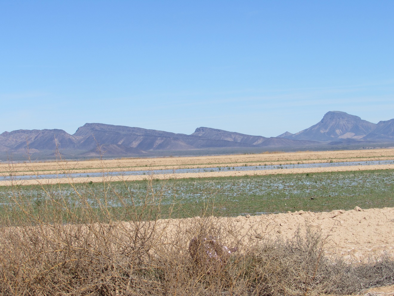
Sunday we hit the road early, for us, shortly after 8:00 A.M.  We had breakfast at Lindsey's Cafe in Van Horn. We arrived at Heuco Tanks State Park at El Paso shortly after 1:00 P.M..MST. When we reserved the site a few days before, we were warned that the next available tours were not until Feb 16.  When we checked in, and asked about this, we found that they do allow self-guided tours, providing there are no more than 70 people 
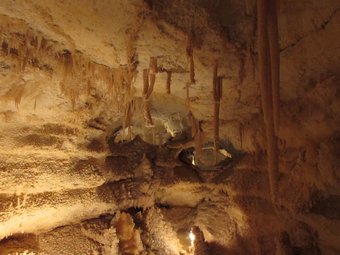
on the trails.  We could go on a self-guided tour at 2:00 PM.  Before we could even set up or go hiking we had to see a video explaining the history and significance of the park, and the does and don'ts.  After the video we headed for the campground.  We did not like the site that had been assigned to us. Too many trees. One of the campground hosts got it changed for us, and we promptly got set up. We then headed off to take advantage of our hiking time slot. We did a number of short trails and in fact one had chains to assist hikers because of the steep trail.  All in all a very nice afternoon, viewing petroglyghs.


We arrived back at the trailer in time for John to watch the Super Bowl and Joan to watch the Ontario men's provincial curling finals.

Monday we headed into El Paso.  It is in T-Mobile territory, so we did our banking and checked a few other things we wanted to do check on our own secure wi-fi. We then did a lot of shopping, mainly Costco and a stop at Walmart to replace one of our electric heaters.  We enjoyed the views of "the Tanks" as we drove back to the trailer for a late lunch. Check the following link for history of the this interesting state park we are presently enjoying.

Tuesday morning we were off to Willcox, Arizona. Not quite as early as we hoped because the gate to the State park is locked until 8:00 A.M. Campers are entitled to  the code, which changes every day, but we figured we wouldn't need it, so we didn't bother to get it. Consequently we waited about 20 minutes before the park ranger arrived to let us out, and three vehicles coming in.  We stopped in Deming New Mexico for a diesel fill and a late breakfast.  Around 2:00 P.M. we arrived at the Magic Circle RV Park in Willcox. Nice park, easy in and out, level sites, no firepits and no trees. Our kind of park.  It even had a resident road runner, which was kind enough to pose behind the trailer.

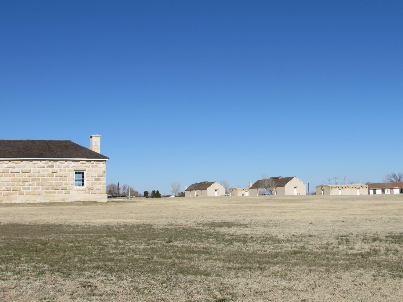
Wednesday morning after a stop at  the visitor information and then Apple Annie's Orchard for an apple pie, we headed to Fort Bowie National Historic Site. We hiked 1.5 miles into the fort, a historic fort instrumental in the capture of Geronimo. Fort Bowie was a 19th-century outpost of the United States Army located in southeastern Arizona near the present day town of Willcox, AZ. It was located in the hills at Apache Springs, an important location.  The remaining buildings and site are now protected as Fort Bowie National Historic Site. Fort Bowie was established by the California Volunteers in 1862 after a series of engagements between the California Column and the Chiricahua Apaches let by Cochise, the most violent of which was the Battle of Apache Pass in July 1862. The fort was named in honor of Colonel George Washington Bowie commander of the 5th Regiment California Volunteer Infantry who first established the fort. The first Fort Bowie resembled a temporary camp rather than a permanent army post. In 1868, a second, more substantial Fort Bowie was built which included adobe barracks, houses, corrals, a trading post, and a hospital. The second Fort Bowie was built on a plateau about 500 yards (460 m) to the east of the first site. For more than 30 years Fort Bowie and  Apache Pass were the focal point of military operations eventually culminating in the surrender of Geronimo in 1886 and the banishment of the Chiricahua Apaches to Florida and Alabama. The Chiricahua tribes were later relocated to Florida, before becoming part of the natives sent to Oklahoma via the Trail of Tears.

Apache Spring
Apache winter home

Fort Bowie Cemetery from Overlook

Cactus flowers

Thursday we completed the Magic Circle drive. Our first stop was Cochise Stronghold, an interesting rocky area located in the Dragoon Mountains at an elevation of 5,000 ft.  This beautiful woodland area lies in a protective rampart of granite domes and sheer cliffs which were once the refuge of the great Apache Chief, Cochise, and his people. For further history of the area see the link .


Our next stop was Chiricahua National Monument.   We planned on stopping at the visitor center first, but the parking lot was full, so we returned to the Faraway Ranch picnic area.  We completed  the Silver Spur Meadow trail, a beautiful hike through the forest with stops at Faraway Ranch, named as such because the lady of the house stated it is faraway from anything, Stafford Cabin, and finally the visitor information center. 

Faraway Ranch

Organ Pipe Formation
Gray Breasted Jay

We stopped at Willcox's Railroad Park, where they have a statue of Rex Allen, who grew up here,  across from his museum, the singing silver screen cowboy movie star.  His most famous song was "Streets of Laredo".

Then we stopped at Safeway for some fresh vegetables. Our first Safeway for a long time, so we are getting into the west part of the country.

Thursday 4 February 2016

Week ending Feb 4, 2016 Garner State Park, Sonora Caverns, Fort Stockton


Friday morning, after watching a rabbit come out of the trees behind us, and after a telephone chat with Mom and  Dad  (we are in a wi-fi dead zone) we went hiking. Our decision to stop at this park was a good one, as there are miles of hiking trails. Our hike started on Bridges trail which took us to Painted Rock overlook with views of  Old Baldy.  We then carried on to the Crystal Cave. John climbed down into the cave to do some exploring. As this cave is open to everyone most of the crystals have been damaged. On the way down from the cave we visited with a couple hiking up to the cave.  We all enjoyed the break.


Where fat free can take a hike

Saturday we did the 2.9 mile Frio Canyon Trail around the level section of the park, across meadows, through cypress and pecan groves, with a variety of other trees.  We stopped at the gift store, which in addition to the usual t-shirts and books, rents  geocaching gps and fishing tackle.  Fishing in the park does not require a permit.  We still haven't seen what we would consider a canyon. We did see people wading in the river.

Red Ants


Sunday morning the bunnies were back.  There was a dog next door on Saturday, which meant we didn't seem them that morning. After breakfast we were off  to our destination,  Sonora Caverns. We stopped on the way in Junction at Lum's BBQ for an early lunch.  We had been thinking about Coopers, since we had visited their store in Llano the last time we were in this area, but Joan's research led us to Lum's instead.  They had nice lean ribs, and good sides.  We had enough leftover for dinner.    When we got to the Caverns, we checked and found out that there was a tour going in half an hour at 1:30 which had space,  so we only needed one night in the rv park. We had  planned to spend 2 nights at the cavern in order to take the tour.    We parked  in our site, plugged into electricity, leveling etc can wait.  What an amazing cavern. The tour took 2 hours, included 360 stairs, but lots of breaks. Only 12 people are allowed on the tour, and a comprehensive set of rules is covered before going into the cavern.  No purses, water or food are allowed to minimize damage.  At one time  a tour member broke off some crystals, and pocketed them.  Someone reported him to the office.  As a result, they successfully petitioned the Texas government to make it a jail term felony to remove crystals from a protected cavern.    Sometime later, someone broke off a piece of the butterfly formation, was caught, and convicted.  The tour guide was very knowledgeable and has spent a lot of his life here at Sonora Cavern.


Bottle brush formation

Unusual angles on deposits
Butterfly formation
As it turned out the site was pretty level, so no need to unhook.  John set up the satellite so we could watch Canadian junior curling finals.

Monday morning we were off early because we decided to stop for breakfast somewhere along the way.  We found the Circle Bar truck stop in Ozona, got diesel, had breakfast in their restaurant and took advantage of their wi-fi.  Our checked the weather at our planned destination, Balmorhea State Park.  We discovered there was a high wind advisory for high profile vehicles in effect for that area.  We did further checking and  decided Fort Stockton was as far as we would go.  We called one RV park, only to get an answering machine saying they were full.  Then we tried Fort Stockton RV Park and got a site.  We arrived fairly early, got set up, chatted with our neighbours from Washington state. They stopped because of the wind as well.  Now that we have good wi-fi we can make some plans for further down the road.  On this rare occasion, we couldn't get a satellite signal, but the cable was good so didn't try too long.  It was pretty windy here too, making a bit difficult to communicate.   There was a poster in the office to head off questions.  "Is it always this windy here?  No, sometimes it blows harder".

Tuesday morning the wind had died down, but the  weather forecast further west promised cold nights. In fact eastern Arizona promised lows in the teens. Since we have time and the weather promises not to be as cold here we decided to stay put until this cold front blew over. We spent the day doing household chores, cleaning the fridge and fun things like that.  We also moved the satellite around until we found a signal.

Wednesday we walked most of the historic Fort Stockton driving tour.
Annie Riggs Hotel (now museum)
Oldest House in Fort Stockton
St Stephens Episcopal
Fort Stockton
This town has interesting beginnings, from the Indian Wars era. Fort Stockton is strategically placed at Comanche Springs to protect the San Antonio to El Paso mail, freight, cattle drives and immigrants from Indian raids. The treaty of  Guadaloupe Hidalgo with Mexico, charged the US army with the task of stopping Apache, Comanche and Kiowa tribes from raiding into northern Mexico, something they had been doing every year for decades. 

Thursday morning we used our furnace for the first time in a while. The temperature had dropped to 27F overnight.  The sun came up and  the day turned warm and sunny. After lunch we enjoyed the Six Shooter trail that encompasses the campground.   We discovered this campground is much larger than we expected, it has 2 annexes that seem to be occupied by long term residents.  We are hoping that the weatherman knows what he is talking about and this cold front from Canada, (Thanks a lot) is on its way east.